
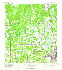
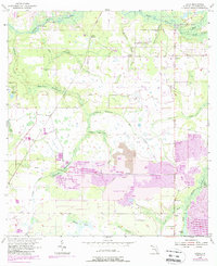
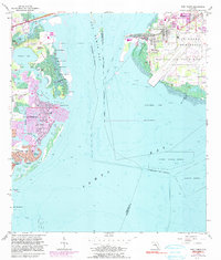
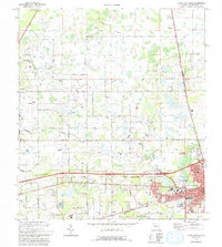
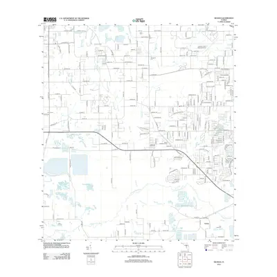
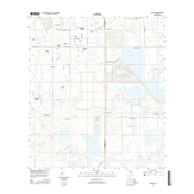
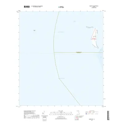
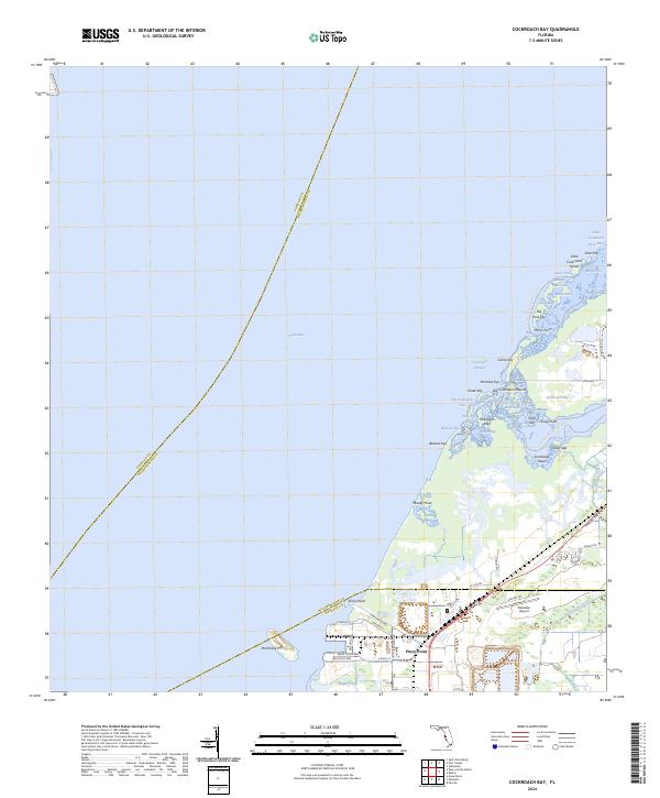
1945 Map of Cockroach Bay
USGS Topo · Published 1945About this map
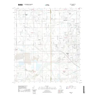
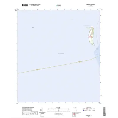
Big Cockroach Mound stands as a prominent landmark on this 1940s survey of the eastern shores of Tampa Bay. The landscape is a complex network of coastal features, including Cockroach Bay, Hallelujah Keys, and Little Cockroach Island. This era captures the transition between the shoreline's natural state and the infrastructure supporting regional transport and navigation. The Atlantic Coast Line railroad and Bayshore Road provide inland connectivity, while maritime aids such as the Cut C Front Range Lt and Cut C Rear Range Lt guide vessels through the bay. To the south, Piney Point is depicted with its Ferry Ldg, illustrating the importance of waterborne transport before more modern crossings were established. The map also delineates civil boundaries between Precinct 80 and Precinct 15 across the Hillsborough and Manatee county line.
Find a feature on this map
53 named features on this map. Tap any name to fly to it.
Don’t see what you’re looking for? This feature index may not catch every label — zoom into the map to look around manually.
Map Details
Editions of this 1945 Cockroach Bay Map
This is the sole edition of this map. No revisions or reprints were ever made.
Historical Maps of Saint Petersburg Through Time
91 maps found

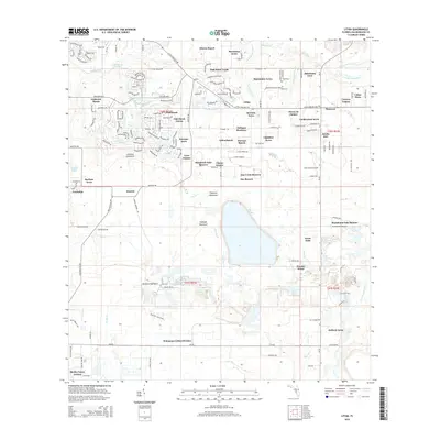
1942 Cockroach Bay
Hillsborough County, FL

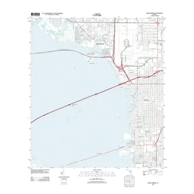
1943 Gandy Bridge
Hillsborough County, FL

1943 Port Tampa
Hillsborough County, FL
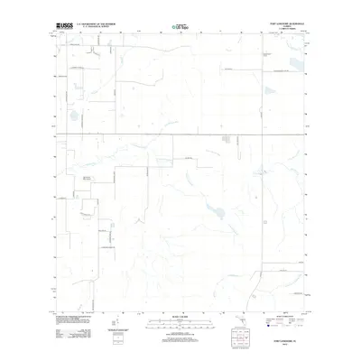
1944 Antioch
Hillsborough County, FL
1944 Egmont Key
Hillsborough County, FL

1944 Sulphur Springs
Hillsborough County, FL
1945 Cockroach Bay
Hillsborough County, FL

1945 Gadsden Point
Hillsborough County, FL

1945 Sulphur Springs
Hillsborough County, FL

1947 Cockroach Bay
Hillsborough County, FL

1947 Gadsden Point
Hillsborough County, FL

1947 Gandy Bridge
Hillsborough County, FL
1947 Port Tampa
Hillsborough County, FL

1949 Sulphur Springs
Hillsborough County, FL
1955 Keysville
Hillsborough County, FL
1955 Lithia
Hillsborough County, FL

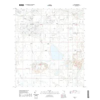
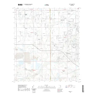
1955 Nichols
Hillsborough County, FL
1956 Cockroach Bay
Hillsborough County, FL
1956 Duette NE
Hillsborough County, FL
1956 Fort Lonesome
Hillsborough County, FL

1956 Gandy Bridge
Hillsborough County, FL
1956 Port Tampa
Hillsborough County, FL
1956 Sulphur Springs
Hillsborough County, FL
1964 Egmont Key
Hillsborough County, FL
1975 Plant City East
Hillsborough County, FL
1975 Plant City West
Hillsborough County, FL

1981 St Petersburg
Hillsborough County, FL

1994 Plant City East
Hillsborough County, FL

1995 Sulphur Springs
Hillsborough County, FL

1998 Gandy Bridge
Hillsborough County, FL
2012 Cockroach Bay
Hillsborough County, FL
2012 Duette NE
Hillsborough County, FL
2012 Egmont Key
Hillsborough County, FL
2012 Fort Lonesome
Hillsborough County, FL
2012 Gandy Bridge
Hillsborough County, FL
2012 Keysville
Hillsborough County, FL
2012 Lithia
Hillsborough County, FL
2012 Nichols
Hillsborough County, FL

2012 Plant City East
Hillsborough County, FL

2012 Plant City West
Hillsborough County, FL

2012 Port Tampa
Hillsborough County, FL

2012 Sulphur Springs
Hillsborough County, FL
2015 Cockroach Bay
Hillsborough County, FL
2015 Duette NE
Hillsborough County, FL
2015 Egmont Key
Hillsborough County, FL

2015 Fort Lonesome
Hillsborough County, FL

2015 Gandy Bridge
Hillsborough County, FL
2015 Keysville
Hillsborough County, FL
2015 Lithia
Hillsborough County, FL
2015 Nichols
Hillsborough County, FL

2015 Plant City East
Hillsborough County, FL

2015 Plant City West
Hillsborough County, FL

2015 Port Tampa
Hillsborough County, FL

2015 Sulphur Springs
Hillsborough County, FL

2018 Cockroach Bay
Hillsborough County, FL
2018 Duette NE
Hillsborough County, FL
2018 Egmont Key
Hillsborough County, FL

2018 Fort Lonesome
Hillsborough County, FL
2018 Gandy Bridge
Hillsborough County, FL
2018 Keysville
Hillsborough County, FL
2018 Lithia
Hillsborough County, FL
2018 Nichols
Hillsborough County, FL

2018 Plant City East
Hillsborough County, FL

2018 Plant City West
Hillsborough County, FL

2018 Port Tampa
Hillsborough County, FL

2018 Sulphur Springs
Hillsborough County, FL
2021 Cockroach Bay
Hillsborough County, FL
2021 Duette NE
Hillsborough County, FL

2021 Egmont Key
Hillsborough County, FL

2021 Fort Lonesome
Hillsborough County, FL
2021 Gandy Bridge
Hillsborough County, FL

2021 Keysville
Hillsborough County, FL
2021 Lithia
Hillsborough County, FL
2021 Nichols
Hillsborough County, FL

2021 Plant City East
Hillsborough County, FL

2021 Plant City West
Hillsborough County, FL

2021 Port Tampa
Hillsborough County, FL

2021 Sulphur Springs
Hillsborough County, FL
2024 Cockroach Bay
Hillsborough County, FL
2024 Duette NE
Hillsborough County, FL
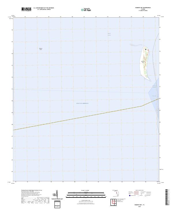
2024 Egmont Key
Hillsborough County, FL
2024 Fort Lonesome
Hillsborough County, FL

2024 Gandy Bridge
Hillsborough County, FL
2024 Keysville
Hillsborough County, FL

2024 Lithia
Hillsborough County, FL
2024 Nichols
Hillsborough County, FL
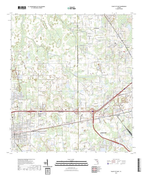
2024 Plant City East
Hillsborough County, FL
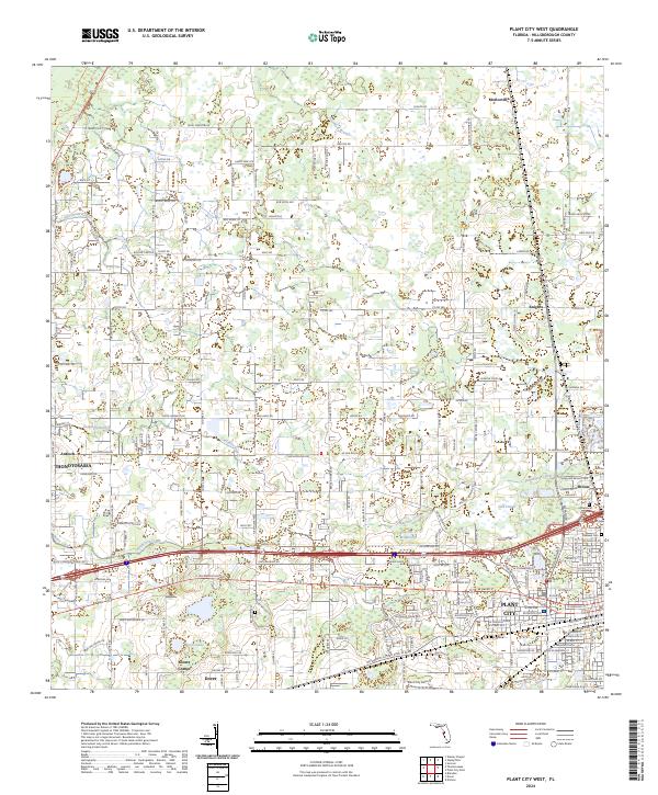
2024 Plant City West
Hillsborough County, FL

2024 Port Tampa
Hillsborough County, FL

2024 Sulphur Springs
Hillsborough County, FL
2025 Egmont Key
Hillsborough County, FL