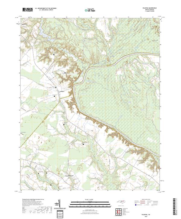
2022 Map of Palmyra
USGS Topo · Published 2022About this map
The Roanoke River carves a sharp, winding boundary through this coastal plain landscape, separating Halifax and Martin counties from Bertie County. The settlement of Palmyra serves as a central point for local families, with numerous burial grounds such as Palmyra Cem and Hyman Cem nearby. Further south, Mount Pilgrim sits at the junction of Iron Mine Spring Rd and Smith Rd, surrounded by ancestral sites like Griffin Cem and Mizell Cem. The eastern portion of the map is dominated by a complex network of wetlands and seasonal waterways, including Thompson Gut, Big Swash, and Matthew Slough. This intricate hydrography, featuring named basins like Blue Hole Swamp, suggests a terrain heavily influenced by the shifting channels and periodic flooding of the river system.
Find a feature on this map
45 named features on this map. Tap any name to fly to it.
Don’t see what you’re looking for? This feature index may not catch every label — zoom into the map to look around manually.
Map Details
Editions of this 2022 Palmyra Map
This is the sole edition of this map. No revisions or reprints were ever made.
Other maps of this area

1901 · Parmele
USGS Topo · 1:62,500

1901 · Williamston
USGS Topo · 1:62,500

1902 · Williamston
USGS Topo · 1:62,500

1902 · Parmele
USGS Topo · 1:62,500

1953 · Norfolk
USGS Topo · 1:250,000

1953 · Rocky Mount
USGS Topo · 1:250,000

1954 · Rocky Mount
USGS Topo · 1:250,000

1962 · Palmyra
USGS Topo · 1:24,000

1962 · Scotland Neck
USGS Topo · 1:24,000

1962 · Norfleet
USGS Topo · 1:24,000