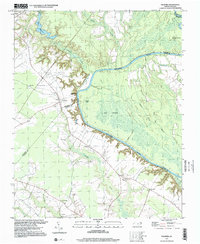
1997 Map of Palmyra
USGS Topo · Published 2000About this map
The Roanoke River dominates this landscape on the boundary of Halifax, Bertie, and Martin Counties, carving a wide, meandering path through dense wetland systems. This environment is characterized by intricate water features like the Big Swash, Matthew Slough, and Blue Hole Swamp, which separate the agricultural uplands from the river's edge. The settlement of Palmyra serves as a local hub, supported by the Palmyra Station and the historic river crossing at Hills Ferry. Genealogy researchers will find a significant concentration of family and community landmarks, including numerous small burial grounds such as Hyman Cem, Griffin Cem, and Charleston Cem. Several rural congregations, notably James Mt Pilgrim Ch and Kehukee Ch, are situated throughout the quadrangle, reflecting the social fabric of these tobacco and cotton farming communities in the late twentieth century.
Find a feature on this map
37 named features on this map. Tap any name to fly to it.
Don’t see what you’re looking for? This feature index may not catch every label — zoom into the map to look around manually.
Map Details
Editions of this 1997 Palmyra Map
This is the sole edition of this map. No revisions or reprints were ever made.
Other maps of this area

1901 · Parmele
USGS Topo · 1:62,500

1901 · Williamston
USGS Topo · 1:62,500

1902 · Williamston
USGS Topo · 1:62,500

1902 · Parmele
USGS Topo · 1:62,500

1953 · Norfolk
USGS Topo · 1:250,000

1953 · Rocky Mount
USGS Topo · 1:250,000

1954 · Rocky Mount
USGS Topo · 1:250,000

1962 · Palmyra
USGS Topo · 1:24,000

1962 · Scotland Neck
USGS Topo · 1:24,000

1962 · Norfleet
USGS Topo · 1:24,000