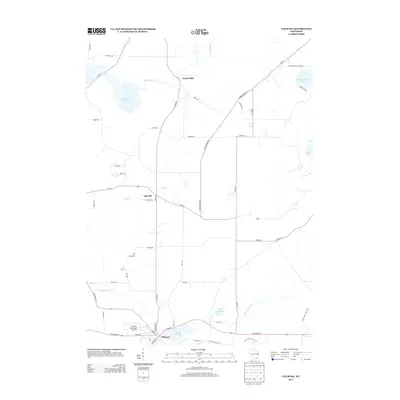
2013 Map of Palmyra
USGS Topo · Published 2013About this map
The Scuppernong River flows through the southern portion of this landscape, anchoring the village of Palmyra. This 2013 survey illustrates a region defined by its glacial hydrology, featuring numerous water bodies such as Spring Lake 38, Upper Spring Lake, and the expansive Rome Pond to the northwest. The northern terrain is marked by the Bark River and the small settlements of Heath Mills and Oak Hill, which sit at the intersection of local routes like Co Hwy-E and Wi-106. For those interested in the modern recreational use of this terrain, the Ice Age Natl Scenic Trl is clearly delineated as it winds through the southeastern wetlands and ridges. The presence of the Palmyra Municipal Airport near the village core reflects the area's contemporary infrastructure amidst its traditional agricultural and river-linked layout.
Find a feature on this map
50 named features on this map. Tap any name to fly to it.
Don’t see what you’re looking for? This feature index may not catch every label — zoom into the map to look around manually.
Map Details
Editions of this 2013 Palmyra Map
This is the sole edition of this map. No revisions or reprints were ever made.
Other maps of this area

1892 · Watertown
USGS Topo · 1:62,500

1892 · Oconomowoc
USGS Topo · 1:62,500

1892 · Whitewater
USGS Topo · 1:62,500

1892 · Eagle
USGS Topo · 1:62,500

1893 · Whitewater
USGS Topo · 1:62,500

1894 · Watertown
USGS Topo · 1:62,500

1894 · Eagle
USGS Topo · 1:62,500

1897 · Eagle
USGS Topo · 1:62,500

1903 · Whitewater
USGS Topo · 1:62,500

1906 · Eagle
USGS Topo · 1:62,500