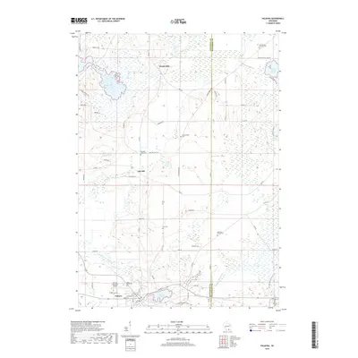
2018 Map of Palmyra
USGS Topo · Published 2018About this map
The Bark River and Scuppernong River systems define this landscape along the border of Jefferson and Waukesha counties. At the heart of the region, Palmyra serves as the primary hub, anchored by the Palmyra Municipal Airport and adjacent to the waters of Spring Lake 38 and Upper Spring Lake. The map reveals a high density of rural burial grounds, including Saint Marys Cem and Saint Theresa Cem, which offer significant value for genealogical research in this part of Wisconsin. North of the village, the terrain transitions into a mosaic of wetlands and small water bodies such as Rome Pond and School Section Lake. Smaller historical settlements like Heath Mills and Oak Hill are connected by a network of county roads, while the open expanse of Melendys Prairie remains a distinct geographic landmark near the Melendys Prairie Cem.
Find a feature on this map
64 named features on this map. Tap any name to fly to it.
Don’t see what you’re looking for? This feature index may not catch every label — zoom into the map to look around manually.
Map Details
Editions of this 2018 Palmyra Map
This is the sole edition of this map. No revisions or reprints were ever made.
Other maps of this area

1892 · Watertown
USGS Topo · 1:62,500

1892 · Oconomowoc
USGS Topo · 1:62,500

1892 · Whitewater
USGS Topo · 1:62,500

1892 · Eagle
USGS Topo · 1:62,500

1893 · Whitewater
USGS Topo · 1:62,500

1894 · Watertown
USGS Topo · 1:62,500

1894 · Eagle
USGS Topo · 1:62,500

1897 · Eagle
USGS Topo · 1:62,500

1903 · Whitewater
USGS Topo · 1:62,500

1906 · Eagle
USGS Topo · 1:62,500