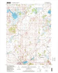
1995 Map of Palmyra
USGS Topo · Published 1999About this map
Glacial topography and marshland define this portion of the Jefferson and Waukesha county border during the mid-1990s. The village of Palmyra serves as the local hub, situated near the headwaters of the Scuppernong River and the fishing waters of Spring Lake. To the north and east, the landscape transitions into the protected wetlands and moraines of the Kettle Moraine State Forest and the Scuppernong State Wildlife Area.
Find a feature on this map
31 named features on this map. Tap any name to fly to it.
Don’t see what you’re looking for? This feature index may not catch every label — zoom into the map to look around manually.
Map Details
Editions of this 1995 Palmyra Map
This is the sole edition of this map. No revisions or reprints were ever made.
Other maps of this area

1892 · Watertown
USGS Topo · 1:62,500

1892 · Oconomowoc
USGS Topo · 1:62,500

1892 · Whitewater
USGS Topo · 1:62,500

1892 · Eagle
USGS Topo · 1:62,500

1893 · Whitewater
USGS Topo · 1:62,500

1894 · Watertown
USGS Topo · 1:62,500

1894 · Eagle
USGS Topo · 1:62,500

1897 · Eagle
USGS Topo · 1:62,500

1903 · Whitewater
USGS Topo · 1:62,500

1906 · Eagle
USGS Topo · 1:62,500