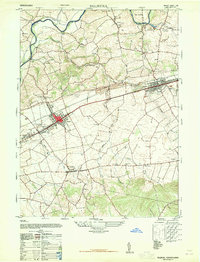
1947 Map of Palmyra
USGS Topo · Published 1965About this map
Palmyra and Annville anchor this 1940s landscape, serving as the primary hubs along the Reading railroad line. The settlement pattern reveals a series of compact villages such as Campbelltown, Palmdale, and Bellegrove, connected by a dense network of local roads and schools. Rural education is particularly prominent, with numerous one-room schoolhouses like Hemperly School, Laurel Grove School, and Meyersville School serving the surrounding farmsteads.
Find a feature on this map
42 named features on this map. Tap any name to fly to it.
Don’t see what you’re looking for? This feature index may not catch every label — zoom into the map to look around manually.
Map Details
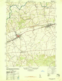
Editions of this 1947 Palmyra Map
2 editions found
Other maps of this area

1891 · Lebanon
USGS Topo · 1:62,500

1892 · Hummelstown
USGS Topo · 1:62,500

1893 · Lebanon
USGS Topo · 1:62,500

1899 · Lebanon
USGS Topo · 1:62,500

1902 · Lancaster
USGS Topo · 1:62,500

1904 · Lancaster
USGS Topo · 1:62,500

1908 · Middletown
USGS Topo · 1:62,500

1924 · Hummelstown
USGS Topo · 1:62,500

1943 · Lancaster
USGS Topo · 1:62,500

1943 · Lebanon
USGS Topo · 1:62,500
Featured Places
- Hershey, Derry Township
- Palmyra, PA
- Campbelltown, South Londonderry Township
- Annville, PA
- East Hanover Township, PA