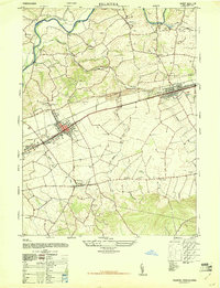
1947 Map of Palmyra
USGS Topo · Published 1947About this map
Annville and Palmyra stand as the primary hubs in this post-war landscape, situated along the critical transit corridor defined by the Reading railroad. The map reveals a transition between concentrated borough life and a rural hinterland densely populated with family-named landmarks and institutions. Numerous schools, including the Hemperly School and Wolfersberger School, are scattered across the landscape, serving local agricultural communities before the consolidation of rural school districts.
Find a feature on this map
44 named features on this map. Tap any name to fly to it.
Don’t see what you’re looking for? This feature index may not catch every label — zoom into the map to look around manually.
Map Details
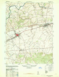
Editions of this 1947 Palmyra Map
2 editions found
Other maps of this area

1891 · Lebanon
USGS Topo · 1:62,500

1892 · Hummelstown
USGS Topo · 1:62,500

1893 · Lebanon
USGS Topo · 1:62,500

1899 · Lebanon
USGS Topo · 1:62,500

1902 · Lancaster
USGS Topo · 1:62,500

1904 · Lancaster
USGS Topo · 1:62,500

1908 · Middletown
USGS Topo · 1:62,500

1924 · Hummelstown
USGS Topo · 1:62,500

1943 · Lancaster
USGS Topo · 1:62,500

1943 · Lebanon
USGS Topo · 1:62,500
Featured Places
- Hershey, Derry Township
- Palmyra, PA
- Campbelltown, South Londonderry Township
- Annville, PA
- East Hanover Township, PA