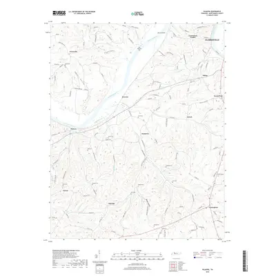
2019 Map of Palmyra
USGS Topo · Published 2019About this map
The Cumberland River carves a winding path through this portion of Montgomery County, defining the landscape between Palmyra and the western edges of Clarksville. This 2019 survey documents a region where modern rural road networks intersect with a deep history of family landholdings, visible through the high density of small cemeteries scattered across the hollows. Settlements like Dotsonville, Cumberland Heights, and Antioch anchor the higher ground, while the river's influence is marked by landmarks such as Sally Martins Bar and Martins Shoal.
Find a feature on this map
116 named features on this map. Tap any name to fly to it.
Don’t see what you’re looking for? This feature index may not catch every label — zoom into the map to look around manually.
Map Details
Editions of this 2019 Palmyra Map
This is the sole edition of this map. No revisions or reprints were ever made.
Other maps of this area

1931 · Erin
USGS Topo · 1:62,500

1944 · Clarksville
USGS Topo · 1:50,000

1951 · New Providence
USGS Topo · 1:24,000

1951 · Clarksville
USGS Topo · 1:24,000

1951 · Woodlawn
USGS Topo · 1:24,000

1956 · Nashville
USGS Topo · 1:250,000

1957 · New Providence
USGS Topo · 1:24,000

1957 · Clarksville
USGS Topo · 1:24,000
1957 · Woodlawn
USGS Topo · 1:24,000
1957 · Clarksville
USGS Topo · 1:62,500