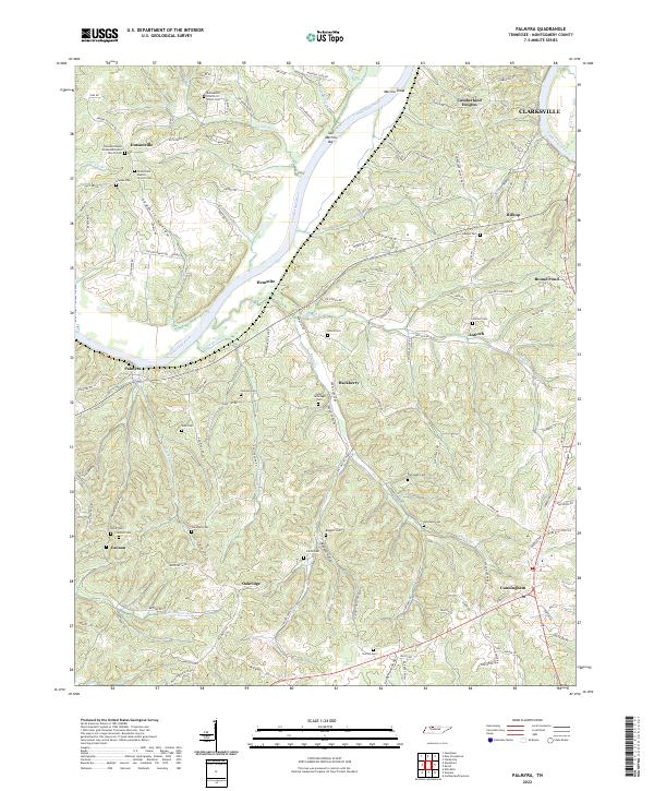
2022 Map of Palmyra
USGS Topo · Published 2022About this map
The Cumberland River bisects this portion of Montgomery County, shaping the settlement patterns and topography from Dotsonville in the northwest down to Cunningham in the southeast. This landscape is defined by the sharp bends of the river, where navigational landmarks like Sall Martins Bar and Martins Shoal sit just below the bluffs of Cumberland Heights. The interior terrain is heavily dissected by drainages such as Antioch Cr and Deason Cr, creating a network of ridges where local communities like Antioch, Oakridge, and Hematite are situated.
Find a feature on this map
130 named features on this map. Tap any name to fly to it.
Don’t see what you’re looking for? This feature index may not catch every label — zoom into the map to look around manually.
Map Details
Editions of this 2022 Palmyra Map
This is the sole edition of this map. No revisions or reprints were ever made.
Other maps of this area

1931 · Erin
USGS Topo · 1:62,500

1944 · Clarksville
USGS Topo · 1:50,000

1951 · New Providence
USGS Topo · 1:24,000

1951 · Clarksville
USGS Topo · 1:24,000

1951 · Woodlawn
USGS Topo · 1:24,000

1956 · Nashville
USGS Topo · 1:250,000

1957 · New Providence
USGS Topo · 1:24,000

1957 · Clarksville
USGS Topo · 1:24,000
1957 · Woodlawn
USGS Topo · 1:24,000
1957 · Clarksville
USGS Topo · 1:62,500