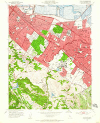
1953 Map of Palo Alto
USGS Topo · Published 1955About this map
Stanford University dominates the central landscape of this early 1950s survey, surrounded by the rapidly expanding residential tracts of the Mid-Peninsula. The map captures the suburban transformation of historic ranch lands like Rancho de las Pulgas and Rincon de San Francisquito into the modern street grids of Palo Alto, Menlo Park, and Redwood City. Educational and institutional infrastructure is dense here, from the Veterans Hospital and St Patricks Seminary to numerous local schools such as Sequoia HS and Menlo-Atherton High Sch. Along the northern edge, the industrial shoreline is defined by Salt Evaporators and the Ravenswood Slough, contrasting with the wooded foothills to the southwest where Searsville Lake and Bear Gulch Reservoir sit near the burgeoning community of Woodside. The Southern Pacific rail line and Bayshore Highway provide the primary transit corridors through this core of Silicon Valley's pre-industrial era.
Find a feature on this map
98 named features on this map. Tap any name to fly to it.
Don’t see what you’re looking for? This feature index may not catch every label — zoom into the map to look around manually.
Map Details
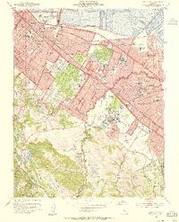
Editions of this 1953 Palo Alto Map
2 editions found
Other maps of this area

1892 · San Mateo
USGS Topo · 1:62,500

1896 · San Mateo
USGS Topo · 1:62,500

1897 · Palo Alto
USGS Topo · 1:62,500

1899 · Palo Alto
USGS Topo · 1:62,500

1899 · Haywards
USGS Topo · 1:62,500

1899 · San Mateo
USGS Topo · 1:62,500

1902 · Santa Cruz
USGS Topo · 1:125,000

1915 · San Mateo
USGS Topo · 1:62,500

1915 · Haywards
USGS Topo · 1:62,500

1939 · San Mateo
USGS Topo · 1:62,500