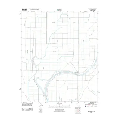
2012 Map of Palo Verde
USGS Topo · Published 2012About this map
The Colorado River forms a dominant boundary in this desert landscape, where a sophisticated network of man-made waterways supports the valley's settlement. Irrigated lands around Palo Verde are partitioned by an extensive system of channels including the C-03 Canal, Estes Drain, and South End Drain. This complex plumbing transforms the arid environment, allowing for the structured grid of rural roads like Spencer Rd and Broadway Ave to stretch across the basin.
Find a feature on this map
77 named features on this map. Tap any name to fly to it.
Don’t see what you’re looking for? This feature index may not catch every label — zoom into the map to look around manually.
Map Details
Editions of this 2012 Palo Verde Map
This is the sole edition of this map. No revisions or reprints were ever made.
Other maps of this area

1942 · Blythe
USGS Topo · 1:250,000

1945 · Cibola
USGS Topo · 1:62,500

1951 · Blythe
USGS Topo · 1:24,000

1951 · Cibola
USGS Topo · 1:62,500

1952 · Mule Wash
USGS Topo · 1:24,000

1952 · Mc Coy Spring
USGS Topo · 1:62,500

1952 · Palo Verde
USGS Topo · 1:24,000

1952 · Ripley
USGS Topo · 1:24,000

1953 · Palo Verde Mountains
USGS Topo · 1:62,500

1954 · Salton Sea
USGS Topo · 1:250,000