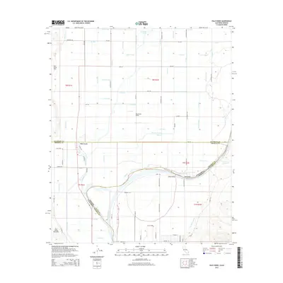
2015 Map of Palo Verde
USGS Topo · Published 2015About this map
Palo Verde Valley is defined by a complex network of irrigation and drainage infrastructure that transformed the arid landscape along the Colorado River. This survey illustrates the intricate water management system serving the agricultural region, featuring dozens of named canals and drains such as C-28 Canal, Norton Drain, and Outfall Drain. The transition from the flat basin to the higher elevation of the Palo Verde Mesa and the Palo Verde Mountains is clearly marked, providing a detailed view of the topographical boundaries in this border region.
Find a feature on this map
88 named features on this map. Tap any name to fly to it.
Don’t see what you’re looking for? This feature index may not catch every label — zoom into the map to look around manually.
Map Details
Editions of this 2015 Palo Verde Map
This is the sole edition of this map. No revisions or reprints were ever made.
Other maps of this area

1942 · Blythe
USGS Topo · 1:250,000

1945 · Cibola
USGS Topo · 1:62,500

1951 · Blythe
USGS Topo · 1:24,000

1951 · Cibola
USGS Topo · 1:62,500

1952 · Mule Wash
USGS Topo · 1:24,000

1952 · Mc Coy Spring
USGS Topo · 1:62,500

1952 · Palo Verde
USGS Topo · 1:24,000

1952 · Ripley
USGS Topo · 1:24,000

1953 · Palo Verde Mountains
USGS Topo · 1:62,500

1954 · Salton Sea
USGS Topo · 1:250,000