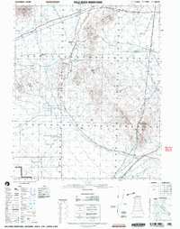
2002 Map of Palo Verde Mountains
USGS Topo · Published 2004About this map
Smoketree Valley and the Palo Verde Mountains dominate this arid landscape along the border of Riverside and Imperial counties. The map documents a rugged desert corridor defined by the historic Bradshaw Trail and Bradshaw Road, routes that have served travelers and miners for generations. Evidence of mineral exploration is scattered across the slopes of the Mule Mountains, where several Mines are noted near Coon Hollow.
Find a feature on this map
17 named features on this map. Tap any name to fly to it.
Don’t see what you’re looking for? This feature index may not catch every label — zoom into the map to look around manually.
Map Details
Editions of this 2002 Palo Verde Mountains Map
This is the sole edition of this map. No revisions or reprints were ever made.
Other maps of this area

1942 · Blythe
USGS Topo · 1:250,000

1945 · Cibola
USGS Topo · 1:62,500

1945 · Picacho
USGS Topo · 1:62,500

1951 · Picacho
USGS Topo · 1:62,500

1951 · Cibola
USGS Topo · 1:62,500

1952 · Mc Coy Spring
USGS Topo · 1:62,500

1952 · Sidewinder Well
USGS Topo · 1:62,500

1952 · Palo Verde
USGS Topo · 1:24,000

1952 · Ripley
USGS Topo · 1:24,000

1953 · Palo Verde Mountains
USGS Topo · 1:62,500