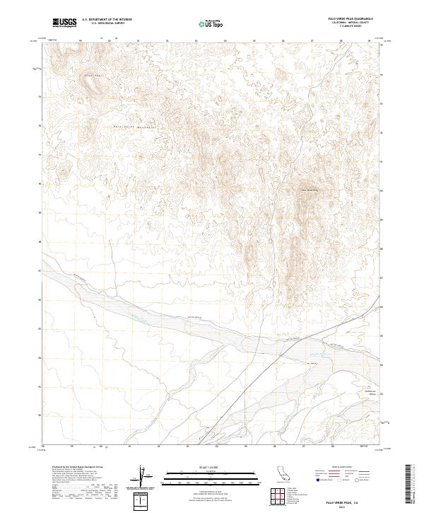
2021 Map of Palo Verde Peak
USGS Topo · Published 2021About this map
Palo Verde Peak anchors the arid landscape of Imperial County, rising above the surrounding Palo Verde Mountains and the expansive Smoketree Valley. The hydrological network is dominated by the broad, sandy stretch of Milpitas Wash, which winds through the southern portion of the territory. Transportation through this remote desert region is defined by unpaved routes like Milpitas Wash Rd and Walters Camp Rd, which follow natural landforms and township boundaries. The terrain north of the peaks transitions into the plateau-like Flat Tops, illustrating the complex geological formations characteristic of the Colorado Desert. The map's layout, organized by various Public Land Survey System townships including t10s r21e and t9s r20e, reflects the systematic grid used to manage these vast, undeveloped public lands.
Find a feature on this map
14 named features on this map. Tap any name to fly to it.
Don’t see what you’re looking for? This feature index may not catch every label — zoom into the map to look around manually.
Map Details
Editions of this 2021 Palo Verde Peak Map
This is the sole edition of this map. No revisions or reprints were ever made.
Other maps of this area

1942 · Blythe
USGS Topo · 1:250,000

1945 · Cibola
USGS Topo · 1:62,500

1945 · Picacho
USGS Topo · 1:62,500

1951 · Picacho
USGS Topo · 1:62,500

1951 · Cibola
USGS Topo · 1:62,500

1952 · Palo Verde
USGS Topo · 1:24,000

1953 · Palo Verde Mountains
USGS Topo · 1:62,500

1953 · Quartz Peak
USGS Topo · 1:62,500

1954 · Salton Sea
USGS Topo · 1:250,000
1954 · Picacho NW
USGS Topo · 1:24,000