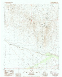
1988 Map of Palo Verde Peak
USGS Topo · Published 1988About this map
Palo Verde Mountains dominate this high-desert landscape in Imperial County, culminating at the prominent Palo Verde Peak. The arid terrain is defined by complex drainage systems, most notably the wide Milpitas Wash which cuts through the southern half of the quadrangle. Exploration and resource extraction are evident across the region, indicated by a scattered Mine and several prospects located near the northern mountain slopes.
Find a feature on this map
15 named features on this map. Tap any name to fly to it.
Don’t see what you’re looking for? This feature index may not catch every label — zoom into the map to look around manually.
Map Details
Editions of this 1988 Palo Verde Peak Map
This is the sole edition of this map. No revisions or reprints were ever made.
Other maps of this area

1942 · Blythe
USGS Topo · 1:250,000

1945 · Cibola
USGS Topo · 1:62,500

1945 · Picacho
USGS Topo · 1:62,500

1951 · Picacho
USGS Topo · 1:62,500

1951 · Cibola
USGS Topo · 1:62,500

1952 · Palo Verde
USGS Topo · 1:24,000

1953 · Palo Verde Mountains
USGS Topo · 1:62,500

1953 · Quartz Peak
USGS Topo · 1:62,500

1954 · Salton Sea
USGS Topo · 1:250,000
1954 · Picacho NW
USGS Topo · 1:24,000