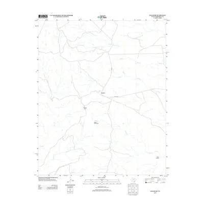
2012 Map of Paloduro
USGS Topo · Published 2012About this map
Paloduro serves as a central point in this part of Armstrong County, where the Texas Panhandle landscape is defined by an intricate network of seasonal drainage and distinct topographic breaks. The terrain transitions from flat plains into the broken country of the Red River watershed, marked by features such as Wagon Wheel Gap and Mitchell Peak. These landmarks, along with Water Canyon to the southeast, suggest a geography shaped by significant erosion, creating a complex series of draws and rises that have historically dictated movement and land use in this arid region.
Find a feature on this map
13 named features on this map. Tap any name to fly to it.
Don’t see what you’re looking for? This feature index may not catch every label — zoom into the map to look around manually.
Map Details
Editions of this 2012 Paloduro Map
This is the sole edition of this map. No revisions or reprints were ever made.
Other maps of this area

1954 · Plainview
USGS Topo · 1:250,000

1958 · Plainview
USGS Topo · 1:250,000

1960 · Indian Peak
USGS Topo · 1:62,500

1963 · Blue Hole Springs
USGS Topo · 1:24,000

1963 · Buffalo Arroyo
USGS Topo · 1:24,000

1963 · Luttrell Springs NE
USGS Topo · 1:24,000

1963 · Paloduro
USGS Topo · 1:24,000

1963 · Tate Arroyo
USGS Topo · 1:24,000
1963 · Gip Creek
USGS Topo · 1:24,000

1965 · Big Betty Reservoir
USGS Topo · 1:24,000