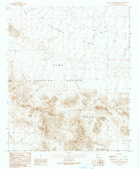
1990 Map of Palomas Mountains NW
USGS Topo · Published 1990About this map
The Yuma Proving Ground dominates this arid landscape at the close of the 1980s, revealing a terrain shaped by both military utility and geological extremes. The southern portion of the map is defined by the high relief of the Tank Mountains, where numerous prospects and adits indicate a history of mineral exploration in the remote desert. Water sources, vital for survival and operations in this environment, are clearly marked at White Tanks, a standalone Water Tank, and various guzzler locations.
Find a feature on this map
14 named features on this map. Tap any name to fly to it.
Don’t see what you’re looking for? This feature index may not catch every label — zoom into the map to look around manually.
Map Details
Editions of this 1990 Palomas Mountains NW Map
This is the sole edition of this map. No revisions or reprints were ever made.
Other maps of this area

1942 · Vicksburg
USGS Topo · 1:250,000

1954 · Phoenix
USGS Topo · 1:250,000

1957 · Phoenix
USGS Topo · 1:250,000

1958 · Phoenix
USGS Topo · 1:250,000

1960 · Phoenix
USGS Topo · 1:250,000

1962 · Little Horn Mts
USGS Topo · 1:62,500

1962 · Kofa Butte
USGS Topo · 1:62,500
1965 · Engesser Pass
USGS Topo · 1:62,500
1965 · Palomas Mts
USGS Topo · 1:62,500

1969 · Phoenix
USGS Topo · 1:250,000