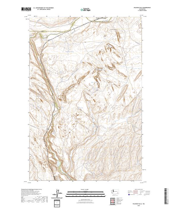
2023 Map of Palouse Falls
USGS Topo · Published 2023About this map
Palouse Falls and Little Palouse Falls dominate this section of the Palouse River, where the water has carved deep into the basalt plateaus of Whitman, Adams, and Franklin counties. This modern survey shows the dramatic transition from the high coulees and plains down to the riverbed, offering a precise look at the land's hydrology. Historical transportation routes like Mullan Rd and Old State Hwy 26 intersect with the Columbia Plateau State Park Trl, tracing the movement of people across this landscape for over a century. The area is dotted with numerous small bodies of water and springs, including Wildcat Lake, Findley Lake, and Gildersleeve Spring. Notable viewpoints like Fryxell Overlook provide vantage points over the complex network of canyons, such as Winn Lake Canyon and Layman Canyon, highlighting the geological power of the river's path.
Find a feature on this map
39 named features on this map. Tap any name to fly to it.
Don’t see what you’re looking for? This feature index may not catch every label — zoom into the map to look around manually.
Map Details
Editions of this 2023 Palouse Falls Map
This is the sole edition of this map. No revisions or reprints were ever made.
Other maps of this area

1923 · Washtucna
USGS Topo · 1:62,500

1925 · Washtucna
USGS Topo · 1:62,500

1948 · Starbuck
USGS Topo · 1:62,500

1948 · Ayer
USGS Topo · 1:62,500

1950 · Starbuck
USGS Topo · 1:62,500

1950 · Haas
USGS Topo · 1:62,500

1950 · Benge
USGS Topo · 1:62,500

1952 · Benge
USGS Topo · 1:62,500

1953 · Walla Walla
USGS Topo · 1:250,000

1958 · Walla Walla
USGS Topo · 1:250,000