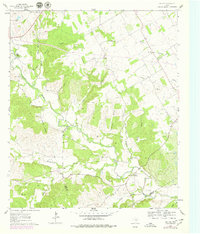
1961 Map of Paluxy
USGS Topo · Published 1979About this map
Paluxy River meanders through the heart of this landscape, carving a deep valley that defines the local geography where the borders of Erath, Hood, and Somervell counties meet. The settlement of Paluxy sits along its banks, serving as a focal point in a territory characterized by complex drainage systems like Richardson Creek and Dunnagan Branch. The Atchison Topeka and Santa Fe railroad cuts across the northern terrain, providing a vital transportation link that influenced the distribution of local landmarks such as Panter Branch Hall.
Find a feature on this map
33 named features on this map. Tap any name to fly to it.
Don’t see what you’re looking for? This feature index may not catch every label — zoom into the map to look around manually.
Map Details
Editions of this 1961 Paluxy Map
2 editions found
Other maps of this area

1889 · Granbury
USGS Topo · 1:125,000

1890 · Stephenville
USGS Topo · 1:125,000

1920 · Stephenville
USGS Topo · 1:125,000

1923 · Granbury 2-a
USGS Topo · 1:48,000

1931 · Tolar
USGS Topo · 1:62,500

1954 · Dallas
USGS Topo · 1:250,000

1954 · Abilene
USGS Topo · 1:250,000

1958 · Dallas
USGS Topo · 1:250,000

1958 · Abilene
USGS Topo · 1:250,000
1960 · Tolar
USGS Topo · 1:24,000