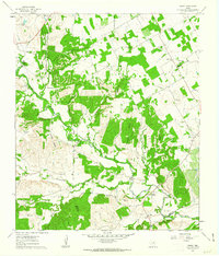
1961 Map of Paluxy
USGS Topo · Published 1963About this map
The Paluxy River winds through this landscape on the borders of Hood, Erath, and Somervell Counties, anchoring a rural community defined by its watercourses and early transit lines. The settlement of Paluxy sits near the river's bend in the southeast, while the Gulf Colorado and Santa Fe railroad cuts across the northwest corner, marking the era's primary industrial corridor. Local life is documented through scattered landmarks like Elm Grove Ch and several burial sites including Glenn Cem and Brooks Cem. The terrain is deeply dissected by a network of named drainages such as Richardson Creek, Sycamore Creek, and Pony Creek, while specific landmarks like Camp Paluxy and various gravel pits suggest a mix of recreational and small-scale extractive land use during the early 1960s.
Find a feature on this map
33 named features on this map. Tap any name to fly to it.
Don’t see what you’re looking for? This feature index may not catch every label — zoom into the map to look around manually.
Map Details
Editions of this 1961 Paluxy Map
2 editions found
Other maps of this area

1889 · Granbury
USGS Topo · 1:125,000

1890 · Stephenville
USGS Topo · 1:125,000

1920 · Stephenville
USGS Topo · 1:125,000

1923 · Granbury 2-a
USGS Topo · 1:48,000

1931 · Tolar
USGS Topo · 1:62,500

1954 · Dallas
USGS Topo · 1:250,000

1954 · Abilene
USGS Topo · 1:250,000

1958 · Dallas
USGS Topo · 1:250,000

1958 · Abilene
USGS Topo · 1:250,000
1960 · Tolar
USGS Topo · 1:24,000