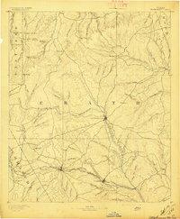
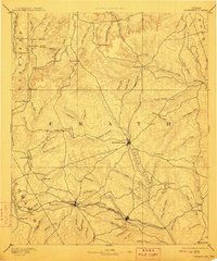
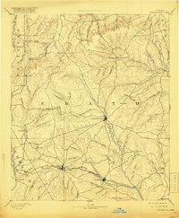
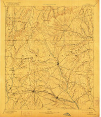
1890 Map of Stephenville
USGS Topo · Published 1890About this map
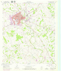
Stephenville serves as the central hub of this late-19th-century landscape, situated along the Bosque River where several local roads and early trails converge. The terrain is defined by a dense network of watercourses and isolated peaks such as Jameson Peaks and Harriet Mountain. In the southern portion of the region, the Texas Central Railroad connects the settlements of Dublin and Alexander, highlighting the rail-driven expansion of the era. Smaller rural outposts like Morgans Mill and Duffau Wells reflect the dispersed agricultural and milling economy that supported the frontier before more intensive development. The map also documents a variety of family-named landmarks and geographic features, including McQuirt Mountain and Counts Creek, providing a detailed look at the local nomenclature and property divisions established shortly after the area was officially surveyed.
Find a feature on this map
95 named features on this map. Tap any name to fly to it.
Don’t see what you’re looking for? This feature index may not catch every label — zoom into the map to look around manually.
Map Details
Editions of this 1890 Stephenville Map
5 editions found
Historical Maps of Stephenville Through Time
9 maps found