Loading...
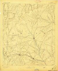
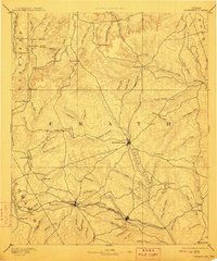
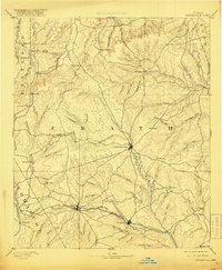
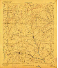
Loading map...1890 Map of Stephenville
USGS Topo · Published 1897About this map
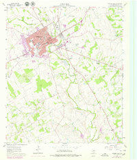
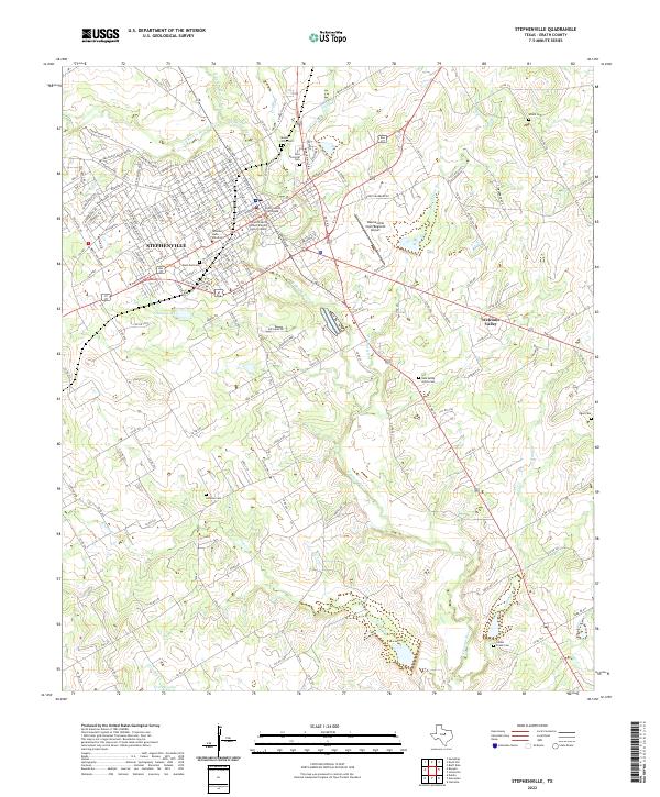
The Stephenville landscape in Erath County is defined by its late nineteenth-century rail and water networks. The Texas Central Railroad cuts a prominent diagonal across the southern half of the sheet, connecting the hubs of Dublin and Alexander. This transit corridor reflects the era's cattle and cotton-driven expansion, linking these settlements to larger markets. Away from the tracks, the terrain is deeply incised by the drainage systems of the North Paluxy and South Paluxy creeks.
Find a feature on this map
95 named features on this map. Tap any name to fly to it.
Don’t see what you’re looking for? This feature index may not catch every label — zoom into the map to look around manually.
Map Details
Date Portrayed1890
Date Published1897
PublisherU.S. Geological Survey
Map TypeTopographic
Scale1:125,000
Physical Dimensions16.5 x 20.1 inches
Editions of this 1890 Stephenville Map
5 editions found

Historical Maps of Stephenville Through Time
9 maps found

Featured Locations
Source Details
SourceU.S. Geological Survey
CopyrightPublic Domain