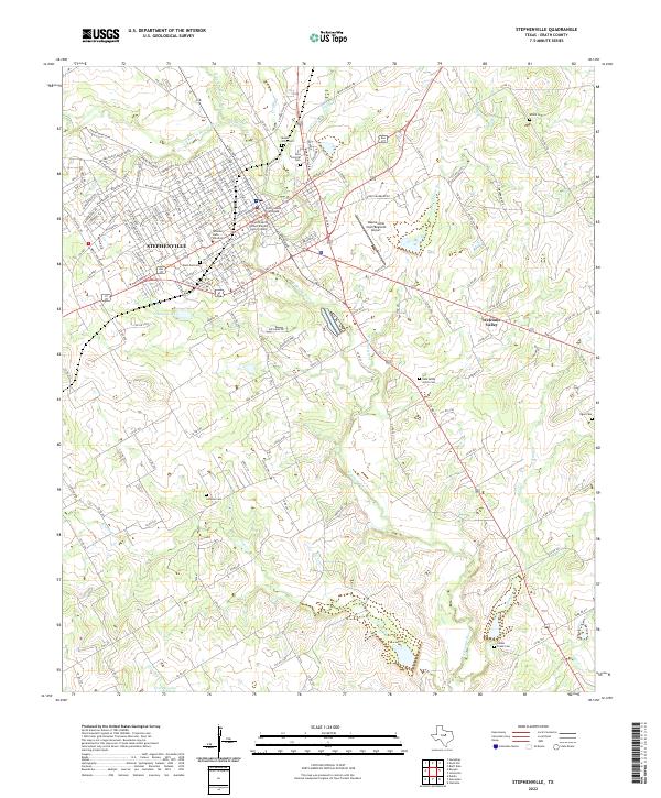
1920 Map of Stephenville
USGS Topo · Published 1920About this map
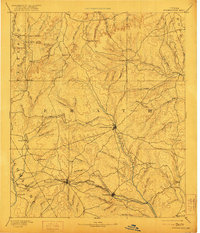
The Stephenville and Dublin corridor serves as a major agricultural and transportation hub in this early twentieth-century military survey. The landscape is defined by the branching tributaries of the Bosque River and the three major rail lines that intersect here, including the Texas Central and the Stephenville North & South Texas railroads. These iron veins supported a network of small settlements and local industry, such as the Morgan Mill and the community at Alexander.
Find a feature on this map
84 named features on this map. Tap any name to fly to it.
Don’t see what you’re looking for? This feature index may not catch every label — zoom into the map to look around manually.
Map Details
Editions of this 1920 Stephenville Map
This is the sole edition of this map. No revisions or reprints were ever made.
Historical Maps of Stephenville Through Time
9 maps found