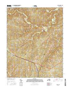
2016 Map of Pamplin
USGS Topo · Published 2016About this map
The Appomattox River winds through the northern reaches of this landscape, marking a geographic boundary and a historic lifeline for the surrounding Virginia countryside. Near the southern border, the hub of Pamplin City and the neighboring community of Pamplin serve as the primary focus of settlement, where the convergence of local roads like Church St and Pamplin Rd suggests a long-standing center of local commerce and transit.
Find a feature on this map
69 named features on this map. Tap any name to fly to it.
Don’t see what you’re looking for? This feature index may not catch every label — zoom into the map to look around manually.
Map Details
Editions of this 2016 Pamplin Map
This is the sole edition of this map. No revisions or reprints were ever made.
Other maps of this area

1892 · Appomattox
USGS Topo · 1:125,000

1947 · Roanoke
USGS Topo · 1:250,000

1956 · Brookneal
USGS Topo · 1:62,500

1956 · Charlotte Court House
USGS Topo · 1:62,500

1958 · Appomattox
USGS Topo · 1:62,500

1958 · Pamplin City
USGS Topo · 1:62,500

1959 · Roanoke
USGS Topo · 1:250,000

1963 · Roanoke
USGS Topo · 1:250,000

1967 · Andersonville
USGS Topo · 1:24,000
1967 · Prospect
USGS Topo · 1:24,000