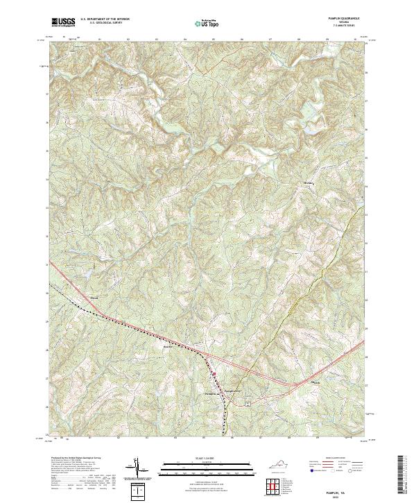
2022 Map of Pamplin
USGS Topo · Published 2022About this map
Pamplin City and the surrounding borderlands of Appomattox and Prince Edward Counties are defined by the headwaters of the Appomattox River, which begins its eastward journey through these dissected uplands. The landscape is marked by a network of small settlements and named rural crossroads such as Hixburg, Flood, and Bowler, connected by a dense web of local roads that follow the ridgelines between drainage basins. To the southeast, the High Bridge Trl follows a historic rail corridor, passing near the community of Shields and crossing several tributaries including Mud Cr and S Br Spring Cr. The area’s historical geography is visible in labels like Old Grist Mill Rd and Heights School Rd, reflecting a traditional rural economy and social structure that persisted into the twenty-first century along the banks of Suanee Cr and Fishpond Cr.
Find a feature on this map
73 named features on this map. Tap any name to fly to it.
Don’t see what you’re looking for? This feature index may not catch every label — zoom into the map to look around manually.
Map Details
Editions of this 2022 Pamplin Map
This is the sole edition of this map. No revisions or reprints were ever made.
Other maps of this area

1892 · Appomattox
USGS Topo · 1:125,000

1947 · Roanoke
USGS Topo · 1:250,000

1956 · Brookneal
USGS Topo · 1:62,500

1956 · Charlotte Court House
USGS Topo · 1:62,500

1958 · Appomattox
USGS Topo · 1:62,500

1958 · Pamplin City
USGS Topo · 1:62,500

1959 · Roanoke
USGS Topo · 1:250,000

1963 · Roanoke
USGS Topo · 1:250,000

1967 · Andersonville
USGS Topo · 1:24,000
1967 · Prospect
USGS Topo · 1:24,000