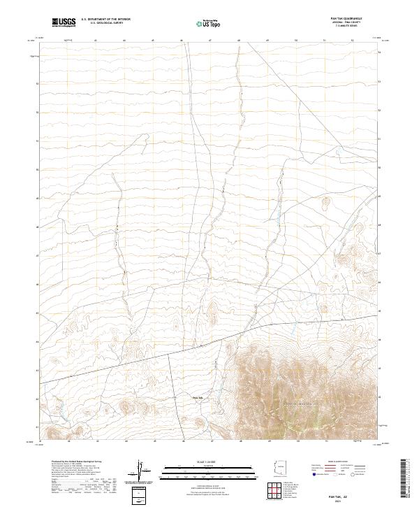
2021 Map of Pan Tak
USGS Topo · Published 2021About this map
The settlement of Pan Tak sits at the foot of the Coyote Mountains in this desert region of Pima County. The landscape is defined by its complex drainage network, where the Pan Tak Wash, Viopuli Wash, and San Vicente Wash cut through the arid terrain. Transportation through this part of the Tohono O'odham Nation is anchored by Indian Rte 39, which provides the primary access through the valley floor. The map illustrates the stark transition from the steep, high-elevation contours of the mountains down to the alluvial plains. This topographic study captures the precise relationship between seasonal watercourses and the established roadway, showing how geographic features dictate the placement of human activity and infrastructure in the Sonoran landscape.
Find a feature on this map
10 named features on this map. Tap any name to fly to it.
Don’t see what you’re looking for? This feature index may not catch every label — zoom into the map to look around manually.
Map Details
Editions of this 2021 Pan Tak Map
This is the sole edition of this map. No revisions or reprints were ever made.
Other maps of this area

1920 · Arivaca
USGS Topo · 1:125,000

1934 · Tucson Mountains
USGS Topo · 1:125,000

1934 · Silver Bell
USGS Topo · 1:125,000

1938 · San Vicente
USGS Topo · 1:62,500

1940 · Palo Alto Ranch
USGS Topo · 1:62,500

1941 · San Vicente
USGS Topo · 1:62,500

1941 · Cocoraque Butte
USGS Topo · 1:62,500

1941 · Baboquivari Peak
USGS Topo · 1:62,500

1942 · San Vicente
USGS Topo · 1:62,500

1943 · Cocoraque Butte
USGS Topo · 1:62,500