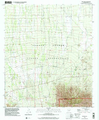
1996 Map of Pan Tak
USGS Topo · Published 2002About this map
Pan Tak and the surrounding desert floor are defined by a complex network of seasonal drainages, including the Viopati Wash and San Vicente Wash, which flow toward the southern horizon near the Coyote Mountains Wilderness. As documented in this mid-1990s imagery, the landscape reflects the dual priorities of tribal land management and resource extraction on the Tohono O'odham Indian Reservation. The presence of the Roadside Mine and scattered prospects suggests a history of mineral exploration, while the identification of San Ignacio Ranch and San Pedro marks the continued human presence across these arid reaches.
Find a feature on this map
21 named features on this map. Tap any name to fly to it.
Don’t see what you’re looking for? This feature index may not catch every label — zoom into the map to look around manually.
Map Details
Editions of this 1996 Pan Tak Map
This is the sole edition of this map. No revisions or reprints were ever made.
Other maps of this area

1920 · Arivaca
USGS Topo · 1:125,000

1934 · Tucson Mountains
USGS Topo · 1:125,000

1934 · Silver Bell
USGS Topo · 1:125,000

1938 · San Vicente
USGS Topo · 1:62,500

1940 · Palo Alto Ranch
USGS Topo · 1:62,500

1941 · San Vicente
USGS Topo · 1:62,500

1941 · Cocoraque Butte
USGS Topo · 1:62,500

1941 · Baboquivari Peak
USGS Topo · 1:62,500

1942 · San Vicente
USGS Topo · 1:62,500

1943 · Cocoraque Butte
USGS Topo · 1:62,500