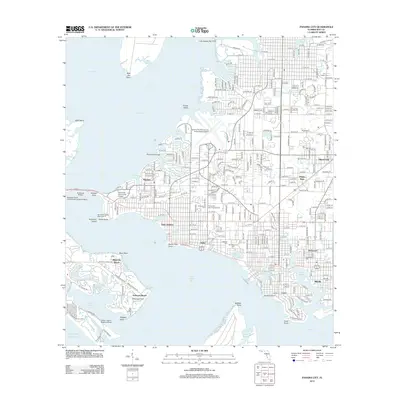
2012 Map of Panama City
USGS Topo · Published 2012About this map
Saint Andrew and its neighboring bayside communities define this coastal portrait of Bay County at the start of the 2010s. The map captures a densely developed grid where the city meets the shoreline, featuring a diverse array of neighborhoods from Millville and Hiland Park to Magnolia Beach. Significant maritime and aviation infrastructure is visible, including the Seaways South Incorporated Seaplane Base and the Panama City-Bay County International Airport. For genealogists and local historians, the sheet is exceptionally well-documented with several burial grounds such as Greenwood Cem, Evergreen Memorial Gardens, and Oakland Cem. The landscape is heavily influenced by the complex waterways of Saint Andrew Bay, North Bay, and West Bay, with the Hathaway Bridge serving as a vital connection across the waters. Educational and community anchors like Gulf Coast Community College are situated alongside recreational spaces like the St Andrews St Rec Area.
Find a feature on this map
135 named features on this map. Tap any name to fly to it.
Don’t see what you’re looking for? This feature index may not catch every label — zoom into the map to look around manually.
Map Details
Editions of this 2012 Panama City Map
This is the sole edition of this map. No revisions or reprints were ever made.
Other maps of this area

1943 · Beacon Beach
USGS Topo · 1:31,680

1943 · Panama City
USGS Topo · 1:31,680

1943 · Panama City Beach
USGS Topo · 1:31,680

1943 · West Bay
USGS Topo · 1:24,000

1943 · Southport
USGS Topo · 1:24,000

1944 · Southport
USGS Topo · 1:24,000

1944 · West Bay
USGS Topo · 1:31,680

1944 · Long Point
USGS Topo · 1:31,680

1944 · Bayhead
USGS Topo · 1:24,000

1945 · Bayhead
USGS Topo · 1:31,680