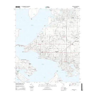
2015 Map of Panama City
USGS Topo · Published 2015About this map
Panama City and its surrounding coastal communities sit at the center of this 2015 survey, revealing a landscape defined by the intricate inlets of Saint Andrew Bay. The map documents the urban and suburban structure of the region, from the established grid of Lynn Haven in the north to the industrial corridors of Springfield and Millville in the east. The geography is dominated by numerous bayous, including Robinson Bayou and Watson Bayou, which dictate the local road network and residential development patterns.
Find a feature on this map
75 named features on this map. Tap any name to fly to it.
Don’t see what you’re looking for? This feature index may not catch every label — zoom into the map to look around manually.
Map Details
Editions of this 2015 Panama City Map
This is the sole edition of this map. No revisions or reprints were ever made.
Other maps of this area

1943 · Beacon Beach
USGS Topo · 1:31,680

1943 · Panama City
USGS Topo · 1:31,680

1943 · Panama City Beach
USGS Topo · 1:31,680

1943 · West Bay
USGS Topo · 1:24,000

1943 · Southport
USGS Topo · 1:24,000

1944 · Southport
USGS Topo · 1:24,000

1944 · West Bay
USGS Topo · 1:31,680

1944 · Long Point
USGS Topo · 1:31,680

1944 · Bayhead
USGS Topo · 1:24,000

1945 · Bayhead
USGS Topo · 1:31,680