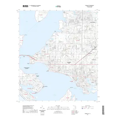
2021 Map of Panama City
USGS Topo · Published 2021About this map
Panama City and the surrounding waterfront of Saint Andrew Bay define this 2021 survey of Bay County. The map details the dense urban and suburban grid spreading from the Bay County Courthouse into neighboring communities like Springfield, Lynn Haven, and Cedar Grove. The coastal geography is marked by a complex network of bayous, including Massalina Bayou and Watson Bayou, which carved the early development patterns of the region. Educational institutions such as Gulf Coast State College and Florida State University Panama City occupy prominent positions along the shoreline near the Hathaway Bridge. Genealogists will find several burial grounds noted, including Greenwood Cem and Millville Cem. The map also captures the critical maritime infrastructure of the Intracoastal Waterway, linking West Bay and East Bay through the heart of the city's waterfront districts.
Find a feature on this map
70 named features on this map. Tap any name to fly to it.
Don’t see what you’re looking for? This feature index may not catch every label — zoom into the map to look around manually.
Map Details
Editions of this 2021 Panama City Map
This is the sole edition of this map. No revisions or reprints were ever made.
Other maps of this area

1943 · Beacon Beach
USGS Topo · 1:31,680

1943 · Panama City
USGS Topo · 1:31,680

1943 · Panama City Beach
USGS Topo · 1:31,680

1943 · West Bay
USGS Topo · 1:24,000

1943 · Southport
USGS Topo · 1:24,000

1944 · Southport
USGS Topo · 1:24,000

1944 · West Bay
USGS Topo · 1:31,680

1944 · Long Point
USGS Topo · 1:31,680

1944 · Bayhead
USGS Topo · 1:24,000

1945 · Bayhead
USGS Topo · 1:31,680