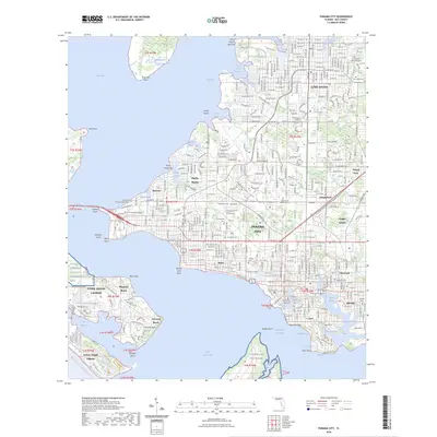
2024 Map of Panama City
USGS Topo · Published 2024About this map
Saint Andrew Bay and its intricate network of bayous form the central character of this 2024 coastal survey. The urban expansion of Panama City is documented alongside established communities such as Lynn Haven, Millville, and Cedar Grove. The map reveals a landscape defined by significant military and educational footprints, ranging from Naval Support Activity Panama City on the western shore to the expansive Tyndall Air Force Base across the water to the south. Local history is etched into the landscape via numerous burial grounds like Lymn Haven Community Cem and Forest Lawn Memorial Cem, while the Intracoastal Waterway cuts through the bay, highlighting the region's enduring maritime importance. For genealogists, the map provides precise locations for the Bay County Courthouse and several neighborhood-specific cemeteries that serve as anchors for the area's diverse settlements.
Find a feature on this map
70 named features on this map. Tap any name to fly to it.
Don’t see what you’re looking for? This feature index may not catch every label — zoom into the map to look around manually.
Map Details
Editions of this 2024 Panama City Map
This is the sole edition of this map. No revisions or reprints were ever made.
Other maps of this area

1943 · Beacon Beach
USGS Topo · 1:31,680

1943 · Panama City
USGS Topo · 1:31,680

1943 · Panama City Beach
USGS Topo · 1:31,680

1943 · West Bay
USGS Topo · 1:24,000

1943 · Southport
USGS Topo · 1:24,000

1944 · Southport
USGS Topo · 1:24,000

1944 · West Bay
USGS Topo · 1:31,680

1944 · Long Point
USGS Topo · 1:31,680

1944 · Bayhead
USGS Topo · 1:24,000

1945 · Bayhead
USGS Topo · 1:31,680