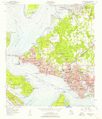
1943 Map of Panama City
USGS Topo · Published 1943About this map
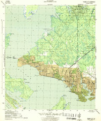
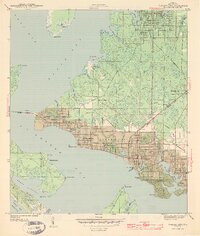
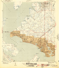
Panama City and its surrounding coastal communities are mapped here during the height of the Second World War, showing the intricate relationship between the urban core and the many inlets of St Andrews Bay. The settlement pattern follows the water, with the industrial and residential hub of Millville situated along Watson Bayou and the developed grid of Lynn Haven to the north on North Bay. The map provides a detailed view of the era's infrastructure, including the Hathaway Bridge crossing and the Panama City Air Port situated on the peninsula. Significant local landmarks such as the Municipal Pier near Bunkers Cove and the Greenwood Cem offer specific points of interest for those researching the mid-century layout of Bay County. This maritime landscape is defined by its labyrinth of waterways, including Massalina Bayou and Upper Goose Bayou, which dictated the growth of neighborhoods like Highland City.
Find a feature on this map
47 named features on this map. Tap any name to fly to it.
Don’t see what you’re looking for? This feature index may not catch every label — zoom into the map to look around manually.
Map Details
Editions of this 1943 Panama City Map
3 editions found
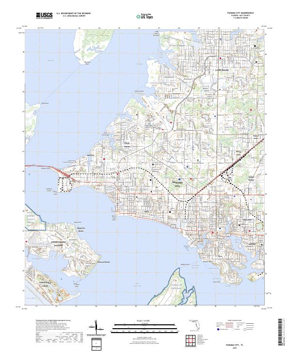
Historical Maps of The Woods III Through Time
5 maps found