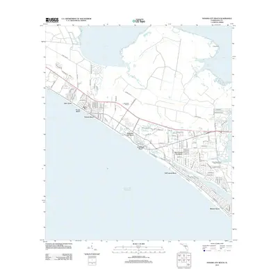
2012 Map of Panama City Beach
USGS Topo · Published 2012About this map
Gulf of Mexico waves meet a dense string of coastal communities in this 2012 survey of the Florida panhandle. The map documents a heavily developed shoreline defined by a contiguous stretch of beach settlements including Open Sands, Florida Beach, and Bid-A-Wee. This residential and resort landscape is characterized by a tightly gridded street network that terminates abruptly at the water's edge, reflecting the region's mid-century and modern growth as a premier vacation destination.
Find a feature on this map
113 named features on this map. Tap any name to fly to it.
Don’t see what you’re looking for? This feature index may not catch every label — zoom into the map to look around manually.
Map Details
Editions of this 2012 Panama City Beach Map
This is the sole edition of this map. No revisions or reprints were ever made.
Other maps of this area

1943 · Beacon Beach
USGS Topo · 1:31,680

1943 · Laguna Beach
USGS Topo · 1:31,680

1943 · Panama City
USGS Topo · 1:31,680

1943 · Panama City Beach
USGS Topo · 1:31,680

1943 · Seminole Hills
USGS Topo · 1:24,000

1943 · West Bay
USGS Topo · 1:24,000

1943 · Southport
USGS Topo · 1:24,000

1944 · Southport
USGS Topo · 1:24,000

1944 · Seminole Hills
USGS Topo · 1:31,680

1944 · West Bay
USGS Topo · 1:31,680
Featured Places
- Panama City Beach, FL
- Biltmore Beach, FL
- Lower Grand Lagoon, FL
- Gulf Lagoon Beach, FL
- Edgewater Gulf Beach, Panama City Beach