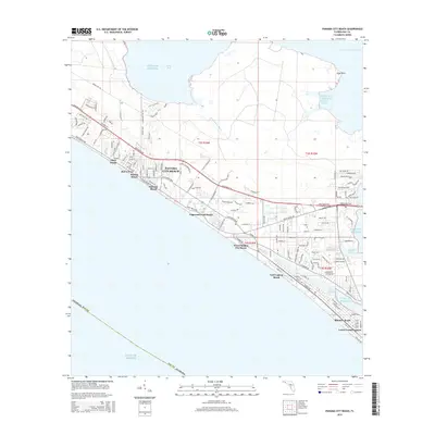
2015 Map of Panama City Beach
USGS Topo · Published 2015About this map
Panama City Beach and its surrounding coastal communities are documented here during a period of dense residential and commercial expansion. This coastal landscape is defined by its series of distinct beach neighborhoods, including Open Sands, Bid-A-Wee, and Bahama Beach, all connected by the primary thoroughfares of Front Beach Rd and Back Beach Rd. The map illustrates the specialized infrastructure of the Florida panhandle, where the built environment meets the complex hydrography of the Gulf of Mexico.
Find a feature on this map
132 named features on this map. Tap any name to fly to it.
Don’t see what you’re looking for? This feature index may not catch every label — zoom into the map to look around manually.
Map Details
Editions of this 2015 Panama City Beach Map
This is the sole edition of this map. No revisions or reprints were ever made.
Other maps of this area

1943 · Beacon Beach
USGS Topo · 1:31,680

1943 · Laguna Beach
USGS Topo · 1:31,680

1943 · Panama City
USGS Topo · 1:31,680

1943 · Panama City Beach
USGS Topo · 1:31,680

1943 · Seminole Hills
USGS Topo · 1:24,000

1943 · West Bay
USGS Topo · 1:24,000

1943 · Southport
USGS Topo · 1:24,000

1944 · Southport
USGS Topo · 1:24,000

1944 · Seminole Hills
USGS Topo · 1:31,680

1944 · West Bay
USGS Topo · 1:31,680
Featured Places
- Panama City Beach, FL
- Biltmore Beach, FL
- Lower Grand Lagoon, FL
- Gulf Lagoon Beach, FL
- Edgewater Gulf Beach, Panama City Beach