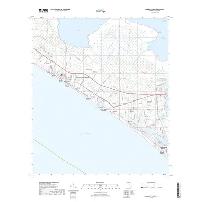
2018 Map of Panama City Beach
USGS Topo · Published 2018About this map
Panama City Beach and its string of coastal neighborhoods define the shoreline in this 2018 survey of the Florida Panhandle. The map illustrates a dense corridor of coastal developments, from Florida Beach and Bid-A-Wee in the west through Edgewater Gulf Beach and Long Beach Resort toward the southeast. This urbanized strip is situated between the open Gulf of Mexico and the intricate wetlands of West Bay and North Bay. Behind the primary beach road, a grid of residential streets like Oleander Cir and Nautilus St gives way to the marshy lowlands of Britheration Branch. At the eastern edge of the quadrangle, the Intracoastal Waterway cuts through toward Saint Andrew Bay, highlighting the area's significance for regional maritime navigation and its reliance on protected lagoons like Grand Lagoon.
Find a feature on this map
124 named features on this map. Tap any name to fly to it.
Don’t see what you’re looking for? This feature index may not catch every label — zoom into the map to look around manually.
Map Details
Editions of this 2018 Panama City Beach Map
This is the sole edition of this map. No revisions or reprints were ever made.
Other maps of this area

1943 · Beacon Beach
USGS Topo · 1:31,680

1943 · Laguna Beach
USGS Topo · 1:31,680

1943 · Panama City
USGS Topo · 1:31,680

1943 · Panama City Beach
USGS Topo · 1:31,680

1943 · Seminole Hills
USGS Topo · 1:24,000

1943 · West Bay
USGS Topo · 1:24,000

1943 · Southport
USGS Topo · 1:24,000

1944 · Southport
USGS Topo · 1:24,000

1944 · Seminole Hills
USGS Topo · 1:31,680

1944 · West Bay
USGS Topo · 1:31,680
Featured Places
- Panama City Beach, FL
- Biltmore Beach, FL
- Lower Grand Lagoon, FL
- Gulf Lagoon Beach, FL
- Edgewater Gulf Beach, Panama City Beach