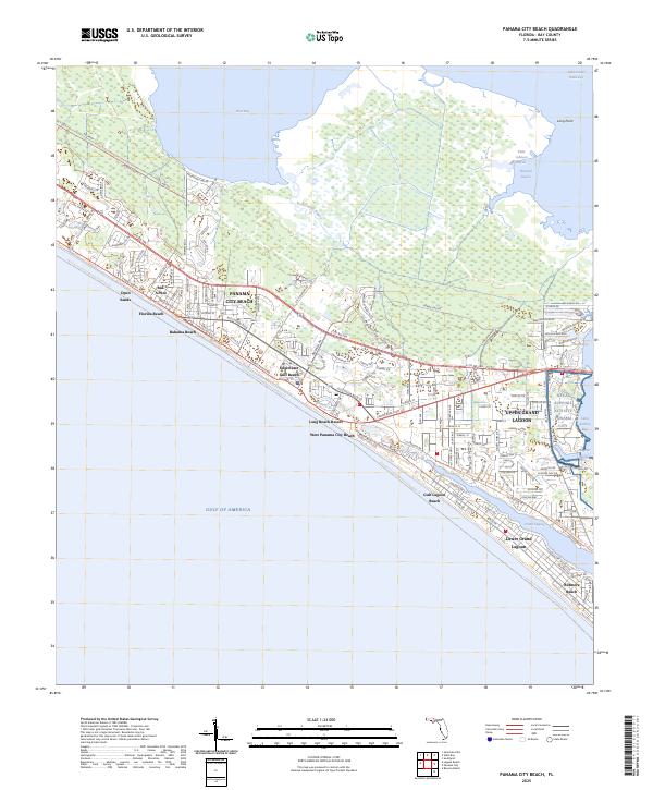
2025 Map of Panama City Beach
USGS Topo · Published 2025About this map
Panama City Beach and its string of coastal settlements define this contemporary survey of the Florida Panhandle. The map captures a densely developed shoreline where Bid-A-Wee, Bahama Beach, and Edgewater Gulf Beach form a continuous residential and resort corridor between the Gulf of America and the northern bay systems. The presence of the Naval Support Activity Panama City on the eastern edge highlights the area's strategic maritime importance, situated between the Upper Grand Lagoon and Saint Andrew Bay.
Find a feature on this map
32 named features on this map. Tap any name to fly to it.
Don’t see what you’re looking for? This feature index may not catch every label — zoom into the map to look around manually.
Map Details
Editions of this 2025 Panama City Beach Map
This is the sole edition of this map. No revisions or reprints were ever made.
Other maps of this area

1943 · Beacon Beach
USGS Topo · 1:31,680

1943 · Laguna Beach
USGS Topo · 1:31,680

1943 · Panama City
USGS Topo · 1:31,680

1943 · Panama City Beach
USGS Topo · 1:31,680

1943 · Seminole Hills
USGS Topo · 1:24,000

1943 · West Bay
USGS Topo · 1:24,000

1943 · Southport
USGS Topo · 1:24,000

1944 · Southport
USGS Topo · 1:24,000

1944 · Seminole Hills
USGS Topo · 1:31,680

1944 · West Bay
USGS Topo · 1:31,680
Featured Places
- Panama City Beach, FL
- West Panama City Beach, Panama City Beach
- Bahama Beach, Panama City Beach
- Biltmore Beach, FL
- Lower Grand Lagoon, FL