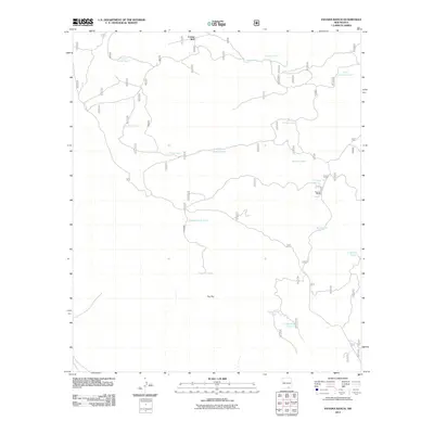
2011 Map of Panama Ranch
USGS Topo · Published 2011About this map
Panama Ranch sits in a high-desert landscape defined by the vital network of water catchments necessary for ranching in this arid Otero County region. The terrain is marked by The Rim, a significant geographic break that overlooks a series of basins. This 2011 survey documents a specialized landscape where human activity is centered almost entirely around water management for livestock, evidenced by the numerous named tanks scattered across the quadrangle. From the northern reaches near Corner Well and Jones Farm Tank to the southern depressions like Lower Dog Tank, the naming conventions such as Pot Hole Tank and Rock Bottom Tank speak to the practicalities of surviving and working this land. Access is provided by a few designated routes, including roads 67 and 518, which link the ranching operations to the surrounding territory.
Find a feature on this map
21 named features on this map. Tap any name to fly to it.
Don’t see what you’re looking for? This feature index may not catch every label — zoom into the map to look around manually.
Map Details
Editions of this 2011 Panama Ranch Map
This is the sole edition of this map. No revisions or reprints were ever made.
Other maps of this area

1943 · Texas Hill
USGS Topo · 1:62,500

1945 · Texas Hill
USGS Topo · 1:62,500

1954 · Carlsbad
USGS Topo · 1:250,000

1958 · Carlsbad
USGS Topo · 1:250,000

1963 · Hackberry Hill
USGS Topo · 1:24,000

1963 · Tanner Ranch
USGS Topo · 1:24,000

1963 · Gowdy Ranch
USGS Topo · 1:24,000

1963 · Panama Ranch
USGS Topo · 1:24,000

1965 · Bullis Spring Ranch
USGS Topo · 1:24,000

1965 · Pinon Ranch
USGS Topo · 1:24,000