
1945 Map of Texas Hill
USGS Topo · Published 1945About this map
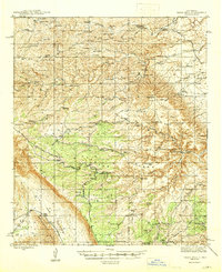
Lincoln National Forest dominates this high-altitude landscape in Otero County, where life in the mid-1940s revolved around isolated water sources and expansive cattle ranges. The map reveals the intricate network of water management essential for desert ranching, featuring numerous tanks such as Neal Tank and Bowman Tank, alongside specialized sites like Bates Windmill. Permanent habitation is centered on established homesteads including the Hardin Ranch and the Armstrong & Armstrong Headquarters Ranch.
Find a feature on this map
99 named features on this map. Tap any name to fly to it.
Don’t see what you’re looking for? This feature index may not catch every label — zoom into the map to look around manually.
Map Details
Editions of this 1945 Texas Hill Map
2 editions found
Other maps of this area

1935 · El Paso Gap
USGS Topo · 1:62,500

1936 · El Paso Gap
USGS Topo · 1:48,000

1940 · El Paso Gap
USGS Topo · 1:62,500

1940 · Bandanna Point
USGS Topo · 1:62,500

1940 · Carlsbad Caverns West
USGS Topo · 1:62,500

1943 · Carlsbad Caverns West
USGS Topo · 1:62,500

1943 · Bandanna Point
USGS Topo · 1:62,500

1943 · Texas Hill
USGS Topo · 1:62,500

1954 · Carlsbad
USGS Topo · 1:250,000

1957 · Box Canyon Ranch
USGS Topo · 1:24,000