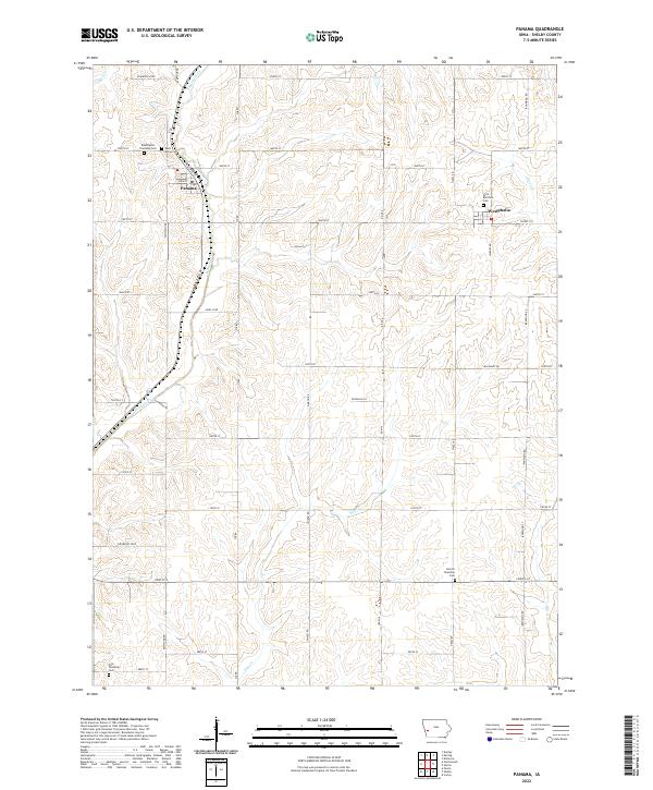
2022 Map of Panama
USGS Topo · Published 2022About this map
Panama and Westphalia anchor this portion of Shelby County, illustrating the enduring agricultural layout of western Iowa. The landscape is defined by the regular section lines of the Public Land Survey System, though the drainage patterns of Mosquito Cr and Pigeon Cr carve more varied terrain across the townships. For local historians and genealogists, the map identifies several key burial sites, including Saint Marys Cem and Saint Boniface Cem, which are central to the area's rural communities. The road network reflects a transition from traditional section-line roads like 1500th St to specialized designations such as Level B Rd and Min Maint Rd, showing the modern management of these historical transit corridors. This survey provides a precise record of the township boundaries and the proximity of outlying cemeteries like Washington Township Cem to the established settlements.
Find a feature on this map
36 named features on this map. Tap any name to fly to it.
Don’t see what you’re looking for? This feature index may not catch every label — zoom into the map to look around manually.
Map Details
Editions of this 2022 Panama Map
This is the sole edition of this map. No revisions or reprints were ever made.
Other maps of this area

1954 · Omaha
USGS Topo · 1:250,000

1957 · Omaha
USGS Topo · 1:250,000

1958 · Omaha
USGS Topo · 1:250,000

1971 · Earling
USGS Topo · 1:24,000

1971 · Dunlap
USGS Topo · 1:24,000

1971 · Defiance
USGS Topo · 1:24,000

1978 · Panama
USGS Topo · 1:24,000

1978 · Corley
USGS Topo · 1:24,000

1978 · Persia
USGS Topo · 1:24,000
1978 · Portsmouth
USGS Topo · 1:24,000