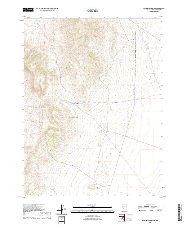
2021 Map of Pancake Summit SW
USGS Topo · Published 2021About this map
Pancake Range dominates the central and western portions of this 2021 landscape, providing a sharp topographic contrast to the broad expanse of Newark Valley to the east. This section of White Pine County reflects the characteristic basin-and-range geography of Nevada, documented through the Public Land Survey System boundaries including t17n r55e and t16n r56e. The map illustrates a primarily undeveloped high-desert environment where the terrain itself is the primary landmark. Researchers and historians can use these contours to understand the natural constraints on movement and settlement in this part of the Great Basin, where the steep slopes of the range abruptly meet the flat, open valley floor.
Find a feature on this map
6 named features on this map. Tap any name to fly to it.
Don’t see what you’re looking for? This feature index may not catch every label — zoom into the map to look around manually.
Map Details
Editions of this 2021 Pancake Summit SW Map
This is the sole edition of this map. No revisions or reprints were ever made.
Other maps of this area

1951 · Green Springs
USGS Topo · 1:62,500

1951 · Pancake Summit
USGS Topo · 1:62,500

1953 · Pinto Summit
USGS Topo · 1:62,500

1956 · Ely
USGS Topo · 1:250,000

1959 · Ely
USGS Topo · 1:250,000

1963 · Ely
USGS Topo · 1:250,000

1964 · Moody Peak
USGS Topo · 1:62,500

1979 · Mt. Hamilton
USGS Topo · 1:100,000

1990 · Pancake Summit SW
USGS Topo · 1:24,000
1990 · Green Springs NW
USGS Topo · 1:24,000