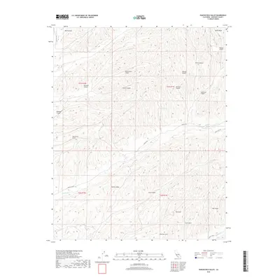
2018 Map of Pancho Rico Valley
USGS Topo · Published 2018About this map
Pancho Rico Cr winds through a deeply dissected landscape within the Diablo Range, defining the character of this corner of Monterey County. The drainage network is dense, with named topographical features like Jim Lawson Gulch, Dutch Henry Canyon, and Portugue Canyon revealing a history of land use likely tied to early ranching and namesake homesteaders. The map shows a primitive road system, including Pancho Rico Rd and Sargents Rd, which follow the natural contours of the valley floors. These corridors provide the primary access to more remote locations such as Deadman Gulch and Windmill Canyon. Small water sources like Banan Spring and Iron Springs highlight the critical role of perennial water in this arid upland environment.
Find a feature on this map
31 named features on this map. Tap any name to fly to it.
Don’t see what you’re looking for? This feature index may not catch every label — zoom into the map to look around manually.
Map Details
Editions of this 2018 Pancho Rico Valley Map
This is the sole edition of this map. No revisions or reprints were ever made.
Other maps of this area

1912 · San Ardo
USGS Topo · 1:31,680

1915 · Priest Valley
USGS Topo · 1:125,000

1919 · San Miguel
USGS Topo · 1:62,500

1919 · Bradley
USGS Topo · 1:62,500

1941 · Priest Valley
USGS Topo · 1:62,500

1941 · San Ardo
USGS Topo · 1:62,500

1941 · Bradley
USGS Topo · 1:62,500

1943 · San Ardo
USGS Topo · 1:62,500

1944 · Priest Valley
USGS Topo · 1:62,500

1947 · San Luis Obispo
USGS Topo · 1:250,000