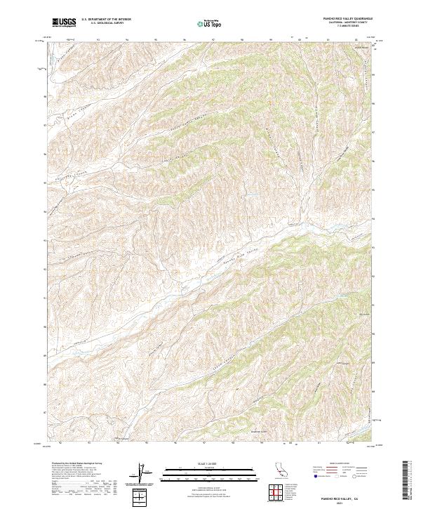
2021 Map of Pancho Rico Valley
USGS Topo · Published 2021About this map
Pancho Rico Valley serves as the central drainage of this segment of the Diablo Range in Monterey County. The landscape is defined by a dense network of steep drainages, including the aptly named Deadman Gulch and Dry Gulch, which feed into the main course of Pancho Rico Cr. The terrain is marked by numerous family and descriptive landmarks such as Dutch Henry Canyon, Jim Lawson Gulch, and Portugee Canyon, suggesting the historical ranching and settlement patterns of this isolated region. Connectivity across the high ridges is maintained by Sargents Rd and Pancho Rico Rd, while water sources like Iron Springs and Biman Spring provide critical points of interest in an otherwise arid and dissected upland environment.
Find a feature on this map
33 named features on this map. Tap any name to fly to it.
Don’t see what you’re looking for? This feature index may not catch every label — zoom into the map to look around manually.
Map Details
Editions of this 2021 Pancho Rico Valley Map
This is the sole edition of this map. No revisions or reprints were ever made.
Other maps of this area

1912 · San Ardo
USGS Topo · 1:31,680

1915 · Priest Valley
USGS Topo · 1:125,000

1919 · San Miguel
USGS Topo · 1:62,500

1919 · Bradley
USGS Topo · 1:62,500

1941 · Priest Valley
USGS Topo · 1:62,500

1941 · San Ardo
USGS Topo · 1:62,500

1941 · Bradley
USGS Topo · 1:62,500

1943 · San Ardo
USGS Topo · 1:62,500

1944 · Priest Valley
USGS Topo · 1:62,500

1947 · San Luis Obispo
USGS Topo · 1:250,000