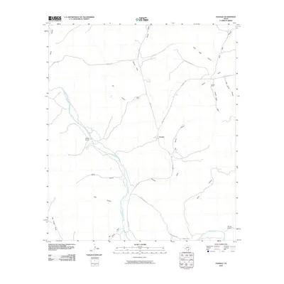
2010 Map of Pandale
USGS Topo · Published 2010About this map
Pandale is the primary settlement on this map, located at a crossing where the high desert terrain is deeply incised by the winding Pecos River. The landscape is dominated by a complex network of arroyos and canyons, including the steep-walled Devils Canyon, Slick Rock Canyon, and Cash Canyon. This geography has historically dictated the placement of ranching operations and the limited road network, such as Pandale Rd and Lantry Rd.
Find a feature on this map
27 named features on this map. Tap any name to fly to it.
Don’t see what you’re looking for? This feature index may not catch every label — zoom into the map to look around manually.
Map Details
Editions of this 2010 Pandale Map
This is the sole edition of this map. No revisions or reprints were ever made.
Other maps of this area

1954 · Sonora
USGS Topo · 1:250,000

1958 · Sonora
USGS Topo · 1:250,000

1970 · Everett Canyon
USGS Topo · 1:24,000

1970 · Antone Canyon
USGS Topo · 1:24,000

1970 · Pandale
USGS Topo · 1:24,000

1970 · Little Fielder Draw
USGS Topo · 1:24,000

1970 · Howards Well SW
USGS Topo · 1:24,000
1970 · Divide Well Draw
USGS Topo · 1:24,000

1973 · Post Canyon
USGS Topo · 1:24,000
1973 · Hackberry Crossing
USGS Topo · 1:24,000