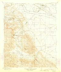
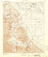
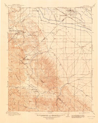
1913 Map of Panoche
USGS Topo · Published 1924About this map
Dos Palos and South Dos Palos anchor the agricultural landscape in the northeast, where the Southern Pacific railroad and a network of canals, including the Main Canal and Outside Canal, define the San Joaquin Valley economy. The terrain shifts dramatically toward the west and south, ascending into the Panoche Hills and Tumey Hills. This rugged transition from valley floor to upland is marked by scattered schools like Center School and Mercy School, reflecting the era's rural community structure.
Find a feature on this map
63 named features on this map. Tap any name to fly to it.
Don’t see what you’re looking for? This feature index may not catch every label — zoom into the map to look around manually.
Map Details
Editions of this 1913 Panoche Map
4 editions found
Other maps of this area

1912 · Coalinga
USGS Topo · 1:125,000

1913 · Panoche
USGS Topo · 1:125,000

1915 · Priest Valley
USGS Topo · 1:125,000

1916 · Santa Rita Bridge
USGS Topo · 1:24,000

1916 · Delta Ranch
USGS Topo · 1:24,000

1918 · Bliss Ranch
USGS Topo · 1:31,680

1919 · San Benito
USGS Topo · 1:62,500

1920 · Pacheco Pass
USGS Topo · 1:62,500

1920 · Santa Rita Bridge
USGS Topo · 1:31,680

1920 · Carrisalito Spring
USGS Topo · 1:31,680