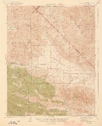
1944 Map of Panoche Valley
USGS Topo · Published 1944About this map
Panoche Valley and the surrounding high country of San Benito County and Fresno County define this 1940s landscape. The settlement of Panoche serves as a central point in the valley, supported by the Panoche Sch and nearby Llanada. Resource extraction is prominent along the ridges, evidenced by the Mercy Mine near Mercy Hot Sprs and the Valley View Mine tucked into the slopes of Las Aguilas Canyon. The terrain transitions from the broad flats of Indian Valley to the steep elevations of Cerro Bonito and Meyers Pk. This survey captures a rural California ranching and mining district before modern development, where isolated outposts like Strohn Rancho and schools like Cherry Hill Sch provided the essential infrastructure for a remote community.
Find a feature on this map
37 named features on this map. Tap any name to fly to it.
Don’t see what you’re looking for? This feature index may not catch every label — zoom into the map to look around manually.
Map Details
Editions of this 1944 Panoche Valley Map
2 editions found

Other maps of this area

1913 · Panoche
USGS Topo · 1:125,000

1915 · Priest Valley
USGS Topo · 1:125,000

1919 · San Benito
USGS Topo · 1:62,500

1921 · Laguna Seca Ranch
USGS Topo · 1:31,680

1921 · Metz
USGS Topo · 1:62,500

1921 · Tierra Loma School
USGS Topo · 1:31,680

1922 · Quien Sabe
USGS Topo · 1:62,500

1923 · Laguna Seca Ranch
USGS Topo · 1:31,680

1923 · Tierra Loma School
USGS Topo · 1:31,680

1923 · Little Panoche
USGS Topo · 1:31,680