
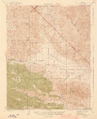
1944 Map of Panoche Valley
USGS Topo · Published 1944About this map
Panoche Valley stretches across this mid-1940s landscape, illustrating a remote ranching and mining corridor on the border of San Benito and Fresno counties. The central settlement of Panoche serves as a hub for the valley, supported by the Panoche Sch and the neighboring Llanada to the west. This era shows a landscape defined by seasonal watercourses like Panoche Creek and Griswold Creek, while the surrounding uplands of the Griswold Hills and Glaucophane Ridge reflect the region's complex geology.
Find a feature on this map
50 named features on this map. Tap any name to fly to it.
Don’t see what you’re looking for? This feature index may not catch every label — zoom into the map to look around manually.
Map Details
Editions of this 1944 Panoche Valley Map
2 editions found
Other maps of this area

1913 · Panoche
USGS Topo · 1:125,000

1915 · Priest Valley
USGS Topo · 1:125,000

1919 · San Benito
USGS Topo · 1:62,500

1921 · Laguna Seca Ranch
USGS Topo · 1:31,680

1921 · Metz
USGS Topo · 1:62,500

1921 · Tierra Loma School
USGS Topo · 1:31,680

1922 · Quien Sabe
USGS Topo · 1:62,500

1923 · Laguna Seca Ranch
USGS Topo · 1:31,680

1923 · Tierra Loma School
USGS Topo · 1:31,680

1923 · Little Panoche
USGS Topo · 1:31,680