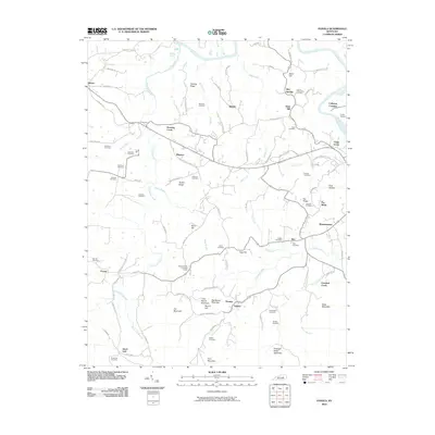
2010 Map of Panola
USGS Topo · Published 2010About this map
Winston and Panola anchor this rural landscape in central Kentucky, where the Kentucky River winds through the northeast corner. The terrain is defined by a series of prominent rises and hollows, including Trotting Ridge, Lily Mountain, and the curious Dark Hollow. Settlement patterns follow the winding creek beds and ridges, with numerous small communities like Drownville, Sand Hill, and Wisemantown dotting the map. This survey is particularly useful for genealogical research, as it identifies over a dozen family-named burial grounds, such as the Robinson Cemetery, Bolan Cemetery, and Richardson Cemetery. Notable landmarks like Thomas Point on Postal Route and the Calla Airport near Calloway Crossing provide insight into the local transportation and mail networks at the start of the 21st century.
Find a feature on this map
97 named features on this map. Tap any name to fly to it.
Don’t see what you’re looking for? This feature index may not catch every label — zoom into the map to look around manually.
Map Details
Editions of this 2010 Panola Map
This is the sole edition of this map. No revisions or reprints were ever made.
Other maps of this area

1892 · Richmond
USGS Topo · 1:125,000

1892 · Beattyville
USGS Topo · 1:125,000

1897 · Richmond
USGS Topo · 1:125,000

1952 · Alcorn
USGS Topo · 1:24,000

1952 · Leighton
USGS Topo · 1:24,000

1952 · Union City
USGS Topo · 1:24,000

1952 · Palmer
USGS Topo · 1:24,000

1952 · Clay City
USGS Topo · 1:24,000

1952 · Irvine
USGS Topo · 1:24,000

1952 · Bighill
USGS Topo · 1:24,000