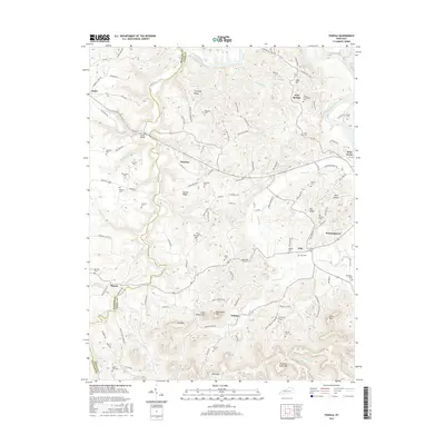
2016 Map of Panola
USGS Topo · Published 2016About this map
Winston and Panola sit at the heart of this East Kentucky landscape where the Kentucky River snakes along the northern and eastern borders. The terrain is defined by a series of prominent ridges and peaks, including Trotting Ridge, Preacher Estes Mtn, and Big Round Mtn, which separate the various creek valleys. For genealogists, the map is a dense record of family landholdings and community centers, marked by numerous small burial sites such as Walton Cem, Bolan Cem, and Riddell Cem. These sites are often found near local crossings and landmarks like the Drowning Creek Bridge. The map details the transition from the river lowlands near West Irvine and Wisemantown to the more isolated uplands, showing how historical settlements like Witt and Noland were shaped by the winding paths of Drowning Creek and Crooked Cr.
Find a feature on this map
119 named features on this map. Tap any name to fly to it.
Don’t see what you’re looking for? This feature index may not catch every label — zoom into the map to look around manually.
Map Details
Editions of this 2016 Panola Map
This is the sole edition of this map. No revisions or reprints were ever made.
Other maps of this area

1892 · Richmond
USGS Topo · 1:125,000

1892 · Beattyville
USGS Topo · 1:125,000

1897 · Richmond
USGS Topo · 1:125,000

1952 · Alcorn
USGS Topo · 1:24,000

1952 · Leighton
USGS Topo · 1:24,000

1952 · Union City
USGS Topo · 1:24,000

1952 · Palmer
USGS Topo · 1:24,000

1952 · Clay City
USGS Topo · 1:24,000

1952 · Irvine
USGS Topo · 1:24,000

1952 · Bighill
USGS Topo · 1:24,000