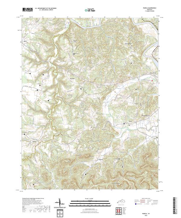
2022 Map of Panola
USGS Topo · Published 2022About this map
The Kentucky River winds along the northern and eastern borders of this Kentucky landscape, defining the jagged border between Madison and Estill counties. A dense network of ridges and knobs dominates the interior, including Trotting Ridge, Turpin Ridge, and the distinctive heights of Little Round Mtn and Big Round Mtn. Settlement is concentrated along the winding roads that follow the contours of the land, with Panola and Winston serving as local hubs.
Find a feature on this map
123 named features on this map. Tap any name to fly to it.
Don’t see what you’re looking for? This feature index may not catch every label — zoom into the map to look around manually.
Map Details
Editions of this 2022 Panola Map
This is the sole edition of this map. No revisions or reprints were ever made.
Other maps of this area

1892 · Richmond
USGS Topo · 1:125,000

1892 · Beattyville
USGS Topo · 1:125,000

1897 · Richmond
USGS Topo · 1:125,000

1952 · Alcorn
USGS Topo · 1:24,000

1952 · Leighton
USGS Topo · 1:24,000

1952 · Union City
USGS Topo · 1:24,000

1952 · Palmer
USGS Topo · 1:24,000

1952 · Clay City
USGS Topo · 1:24,000

1952 · Irvine
USGS Topo · 1:24,000

1952 · Bighill
USGS Topo · 1:24,000